Subject: Eastern Canada
Period: 1784 (dated)
Publication:
Color: Hand Color
Size:
33.9 x 22.9 inches
86.1 x 58.2 cm
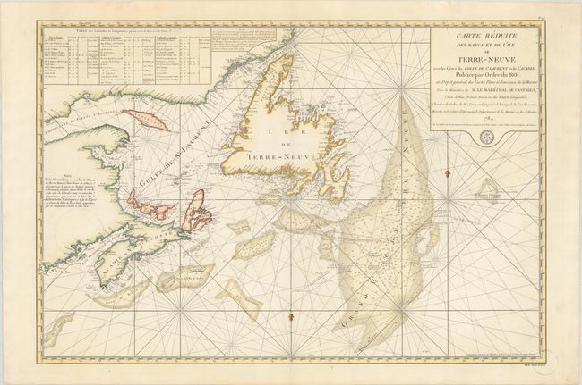
This attractive sea chart depicts the Gulf of St. Lawrence along with Anticosti Island, Prince Edward Island (Isle St Jean), Cape Breton Island (Isle Royale), Newfoundland and the adjacent mainland. It extends to show the fish-rich Grand Bank, as well as the smaller banks located off the coasts of Newfoundland and Nova Scotia. The chart provides excellent detail including bays, offshore islands, numerous soundings, and radiating rhumb lines. Adorned by a block-style title cartouche with the seal of the Depot de la Marine.
This chart was produced shortly after the signing of the Treaty of Versailles in 1783 in which the English retained Newfoundland and surrounding islands, while the French retained Saint Pierre and Miquelon. It became an important source document for the French to manage their fishing rights on the western coast of Newfoundland and in the Gulf of St. Lawrence per the treaty. Several routes of French fishing vessels appear on the chart around both Grand Bank and Newfoundland.
References:
Condition: A
Beautiful impression and color on "Depot de la Marine" watermarked paper. There are a few unobtrusive circles drawn in pencil at left and bottom right, and a few minor edge tears confined to the top blank margin have been archivally repaired on verso.