Catalog Archive
Auction 170, Lot 669

"Carte de la Barbarie, Nigritie et de la Guinee avec les Pays Voisins, Dressee sur les Memoires les Plus Nouveaux & les Observations les Plus Exactes", Chatelain, Henry Abraham
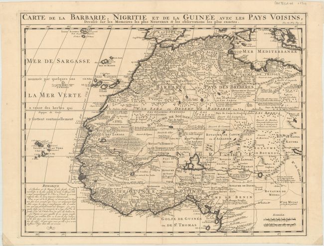
Subject: Northwestern Africa

Period: 1710 (circa)

Publication:

Color: Black & White

Size:
20.2 x 15.8 inches
51.3 x 40.1 cm
Download High Resolution Image
(or just click on image to launch the Zoom viewer)

This great map of western Africa is based on Guillaume Delisle's map. It covers from the Barbary coast to below the equator. There is a mass of geographic detail and notations in the interior with information on the rivers and lakes. Numerous tent encampments are depicted throughout the Sahara Desert.

References:

Condition: B+

A dark impression on paper with a Strasbourg Lily watermark, a light stain and two small abrasions around the centerfold at bottom, and a short centerfold separation that just enters the neatline at bottom. There are small pieces of cello tape in the bottom corners of the sheet on recto, well away from the image.

Estimate: $200 - $230

Sold for: $110

Closed on 11/14/2018

Archived