Subject: Eastern China, Macao
Period: 1808 (published)
Publication: Voyages a Peking, Manille et l'Ile de France…
Color: Black & White
In 1784 Chretien Louis Joseph de Guignes traveled to China as Resident of France in China and consul at Canton. From 1794-95, de Guignes served as an interpreter while traveling through eastern China with Isaac Titsingh, the Dutch ambassador to the court of the Qianlong Emperor of China. Heading to Beijing to celebrate the sixtieth anniversary of the Qianlong Emperor's reign, Titsingh and his colleagues conformed to the demands of the Chinese court etiquette and succeeded in developing good relations with China. De Guignes and the members of the Titsingh mission were the last European diplomats to appear before the Imperial court until after the Opium Wars of the next century. During his journey, de Guignes made observations on Chinese history, society and culture, geography, economics, and manufacturing. Upon returning to France in 1801, de Guignes published an account of his 17 years of travels through China, the Philippines, and Mauritius in Voyages a Peking, Manille et l'Ile de France, faits dans l'intervalle des annees 1784 a 1801. The following two (of five) maps were included in de Guignes' account and engraved by D'Houdan:
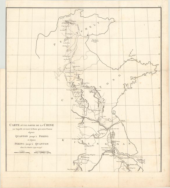
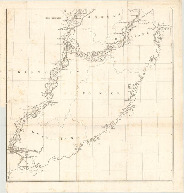
A. Carte d'une Partie de la Chine sur Laquelle est Tracee la Route qu'a Suivie l'Auteur Depuis Quanton Jusqu'a Peking et Depuis Peking Jusqu'a Quanton..., (20.1 x 21.3"). This scarce two-sheet map depicts de Guignes' journey through eastern China from Canton (Guangzhou) to Beijing and back. There is good detail of lakes, rivers, mountains and towns along the route, and travel dates are also marked. A note offshore of present-day Hebei province (here called Petchely) depicts where George Macartney, the first envoy of Great Britain to China, anchored his ship in 1793. The famous Macartney Embassy was aimed at easing trade restrictions between Great Britain and China, but was unsuccessful. Condition: Light scattered foxing. Both sheets have binding trims at left, with the southern sheet having a short binding tear that is closed on verso with archival tape.
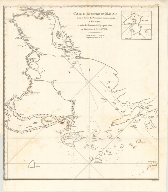
B. Carte de l'Entre de Macao avec la Route des Vaisseaux pour se Rendre a Wampou et Celle des Bateaux du Pays pour Aller par l'Interieur a Quanton, (16.4 x 18.3"). This map covers the Pearl River estuary from Macau north to Guangzhou (Canton) and east to Hong Kong. The map shows basic detail limited to the coastlines with a number of place names identified and depth soundings in the water. Includes an inset of Shangchuan Island at top right. Condition: Light scattered foxing and a few minor stains. There is a binding trim at lower left.
We have found only two examples of the first map and one example of the second map offered separately in the last 30 years.
References:
Condition: B+
Issued folding on heavy, watermarked paper. See description above for additional details.