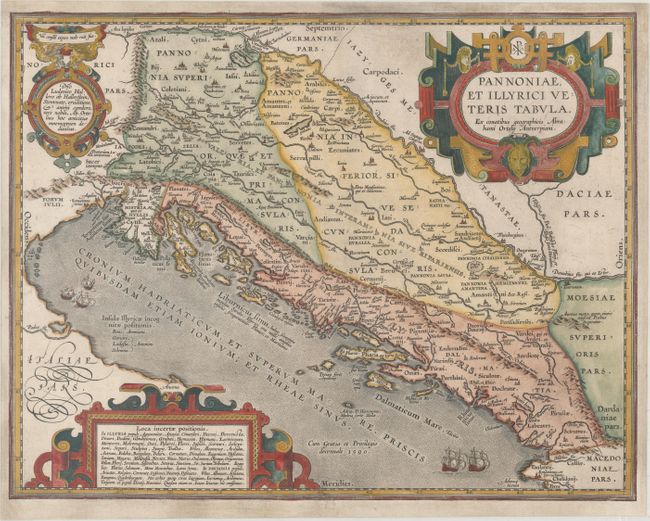
Subject: Western Balkans
Period: 1590 (dated)
Publication: Theatrum Orbis Terrarum
Color: Hand Color
Size:
18.1 x 14.1 inches
46 x 35.8 cm
Superb historical map of the Dalmatian coast from Italy to Greece. The map is based on Gastaldi's map of South East Europe (1560) and other information from ancient sources, specifically Plinius, Livius, Bonfinius, Dionus and Aurelius Victor. Decorated with three fine strapwork cartouches, and several ships sailing in the Adriatic Sea. Blank verso, published circa 1618.
References: Van den Broecke #203.
Condition: B+
A nice impression on paper with a "NR" watermark and a short tear at bottom center that has been professionally repaired. The map has also been professionally remargined with the neatline seamlessly replaced in facsimile.