Subject: Russia, Scandinavia & Baltic
Period: 1680 (circa)
Publication: The English Atlas
Color: Hand Color
Size:
21.7 x 18.5 inches
55.1 x 47 cm
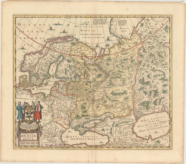
This map is based on the travels of Isaac Massa, the Dutch traveler & merchant, who first visited Russia during the Time of the Troubles. When he returned to Holland in 1609 he brought a rich collection of historical, geographical, ethnographic, and cartographic material that formed the basis of this and several other important maps of the region from this period. The map covers all of Scandinavia and the Baltic region thought to include the Black and Caspian seas. It is nicely detailed including engraved forests and mountains. The plate was originally engraved by Jan Jansson. After his death it was inherited by his son-in-law, known as Jansson-Waesberg, who published it in conjunction with Moses Pitt. This map was published in Volume I of Pitt's The English Atlas, which was initially planned as 12 volumes, but only four volumes were published before Pitt abandoned the project due to debt. This edition adds a graticule and an imprint reading "Apud Janssonio-Waesbergios, et Mosem Pitt."
References: Van der Krogt (Vol. I) #1800:1B.3.
Condition: A
A crisp impression with faint toning along the centerfold at top and minor offsetting. There is a 1.5" centerfold separation confined to the bottom blank margin.