Subject: Ancient World
Period: 1741 (published)
Publication: Description Exacte de l'Univers, ou l'Ancienne Geographie Sacree et Profane
Color: Hand Color
Size:
18.8 x 14.1 inches
47.8 x 35.8 cm
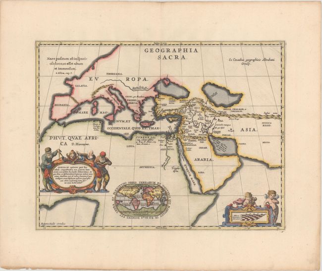
Dramatic and beautifully engraved map of the ancient Biblical world including southern Europe, northern Africa and the Middle East. It depicts the world known to the ancients and is based on the Old and New Testament, following the translation of the Septuaginata. At the bottom of the map is small (4.2 x 2.7") inset map of the modern world on an oval projection surrounded with a decorative strapwork cartouche. Three additional strapwork cartouches adorn the map, with the one at left describing Ophir, the mythical land where Solomon got the gold to build his famous temple in Jerusalem. The world map shows the mythical Ophir in four possible locations; Southeast Asia, South Africa, the West Indies and South America. Blank verso, published in Pieter de Hondt's Description Exacte de l'Univers, ou l'Ancienne Geographie Sacree et Profane, a French edition of Georgius Hornius' Accuratissima Orbis Antiqui Delineatio, which included maps from Johannes Jansson's historical atlas and Abraham Ortelius' Parergon.
References: Van der Krogt (Vol. I) #0810H:1.
Condition: A
A dark impression on a clean sheet with wide margins and minor toning along the edges of the sheet.