Subject: Europe, World War I
Period: 1914 (dated)
Publication:
Color: Printed Color
Size:
25.4 x 17 inches
64.5 x 43.2 cm
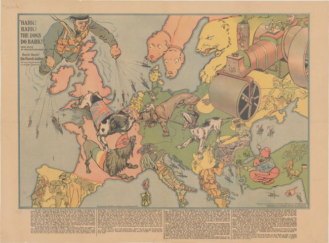
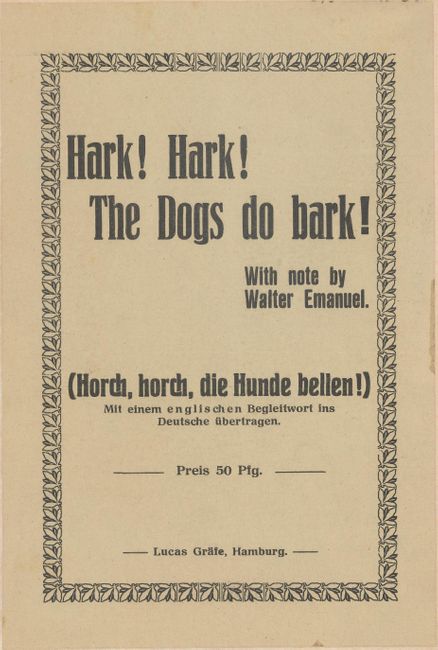
This very rare political caricature map of Europe depicts the continent at the outbreak of World War I, or as it was called at the time the Great War. The principal countries in the conflict are depicted as the Dogs of War. Germany is identified as an aggressive Dachshund attached to its Austrian ally shown as a yapping mongrel. Opposing them is the dandified French Poodle and the British Bulldog who has chomped onto the Dachshund's nose. Russia is depicted both as a traditional bear and as a massive steamroller driven into the heart of Europe by a determined-looking Tsar. A giant British sailor is puppeteer for a huge naval fleet, while a Turk with his pet Dachshund controls a small German fleet in the Black Sea. The other countries are also boldly caricatured with humorous illustrations - a Spanish bullfighter; a knife-wielding Greek; an Italian carabinieri; a Swiss mountaineer; and a Serbian mosquito. It would take a good deal of study to understand the totality of this map's political and satirical nuances. The title draws on the Mother Goose nursery rhyme. At bottom is explanatory text by Walter Emmanuel, a famous English humorist. This map was originally designed and printed by Johnson, Riddle & Co. and published by G. W. Bacon & Co. in London in 1914. This issue was copied from the original by E. Zimmermann and published by Walter Nolting in Hamburg in 1915. An abbreviated version of Emmanuel's text appears in both English and German, although Nolting has added a commentary at the end: "This article has been translated to show the Germans the hopes that the perfidious Albion cling to, and how our glorious victories put their hopes to shame. After this twisted narrative, it seems that the bulldog is in greater need of a muzzle than the dachshund." Issued folding with printed title paste-down on verso.
Although the human personification of continents and countries can be seen as early as the 14th century (on maps by Opicinus de Canestris), human and animal metaphors on maps reached a new level in Europe between 1845 and 1945 with political cartoon maps. The rise of these satirical maps reflected the momentous political and cultural changes that occurred during the time. Political leaders were caricaturized and European nations were given symbolic identities that lent humor and accessibility to the geographical map. Based on popular stereotypes, these visual representations even found their way into the classroom to help bring geography and politics to life. Original serio-comic maps are very scarce due to their ephemeral nature.
References: Baynton-Williams, pp. 206-07; Curtis & Pederson, pp. 22-23; PJ Mode Collection #2207.01.
Condition: B+
Light toning with folds professionally reinforced on verso, repairing some small separations and holes along the folds. A previous owner's ink inscription shows through from verso at top left, well away from the image.