Subject: Europe & Mediterranean
Period: 1741 (published)
Publication: Description Exacte de l'Univers, ou l'Ancienne Geographie Sacree et Profane
Color: Hand Color
Size:
18.8 x 14.9 inches
47.8 x 37.8 cm
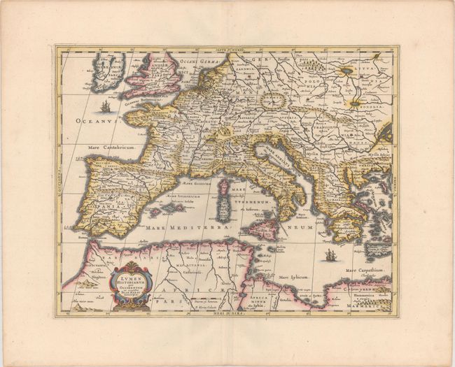
Fine map that covers most of Europe, the western Mediterranean Sea and the adjacent African coast. Frans van Haren (more commonly called Haraeus) was a theologian, historian, globe maker and mapmaker from around 1615 to 1624. He prepared two maps centered on the Mediterranean Sea for Abraham Ortelius' classical atlas that described the world known to the ancients. This is Jansson's version of the western map from Georg Horn's classical atlas. It was engraved by Pieter van den Keere (Petrus Kaeius). Blank verso, published in Pieter de Hondt's Description Exacte de l'Univers, ou l'Ancienne Geographie Sacree et Profane, a French edition of Georgius Hornius' Accuratissima Orbis Antiqui Delineatio, which included maps from Johannes Jansson's historical atlas and Abraham Ortelius' Parergon.
References: Van der Krogt (Vol. I) #0822H:1.
Condition: A
A sharp impression on a clean sheet with wide margins and minor toning along the edges of the sheet.