Subject: Paraguay & Uruguay
Period: 1757 (published)
Publication: Prevost's Histoire Generale des Voyages
Color: Black & White
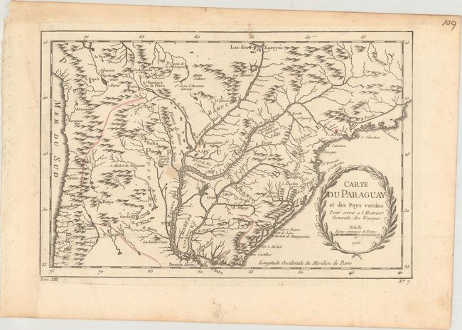
A. Carte du Paraguay et des Pays Voisins pour Servir a l'Histoire Generale des Voyages, dated 1756 (12.3 x 8.1"). Detailed chart covering the region of northern Argentina with Paraguay, Uruguay, southern Brazil and part of Bolivia and Chile. The mythical Lac des Xareyes is shown as the source of the La Plata River at the top of the map, and Buenos Aires is shown at the bottom.
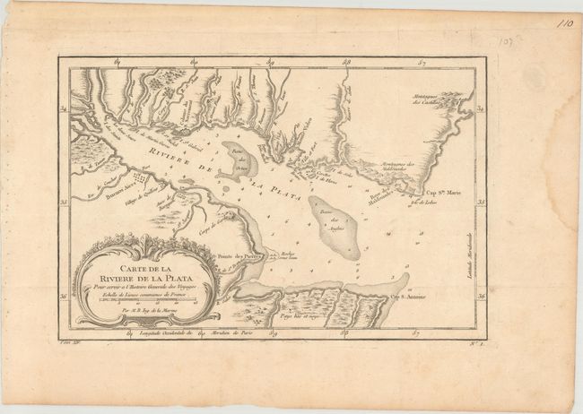
B. Carte de la Riviere de la Plata..., published 1757 (11.1 x 7.3"). This chart details the mouth of the Rio de la Plata with Buenos Aires shown on a grid plan. The bay is marked with soundings, anchorages, and shoals. Decorative rococo-style title cartouche with distance scale.
References:
Condition: B+
Nice impressions, issued folding, on watermarked paper. There is a small stain near the center of the first map, and a damp stain confined to the right blank margin on the second map. The left margin on the first map has been professionally extended with period-correct paper.