Subject: Gulf of Mexico & Caribbean
Period: 1786 (published)
Publication:
Color: Hand Color
Size:
19.5 x 25.9 inches
49.5 x 65.8 cm
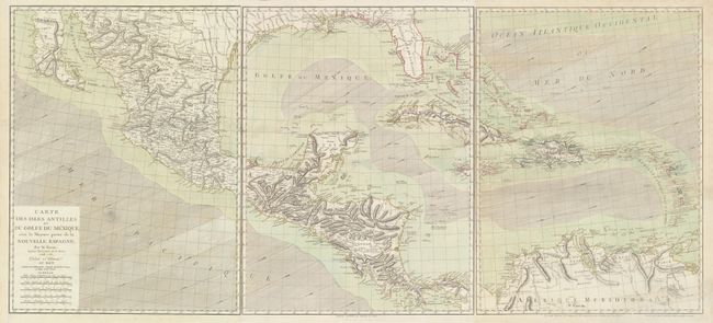
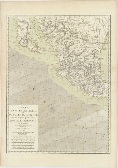
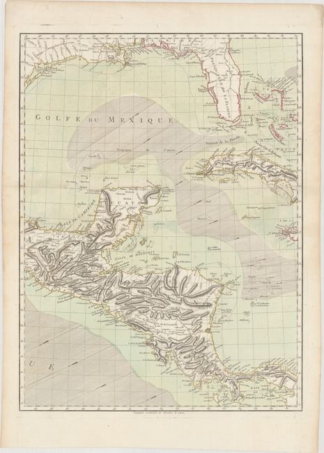
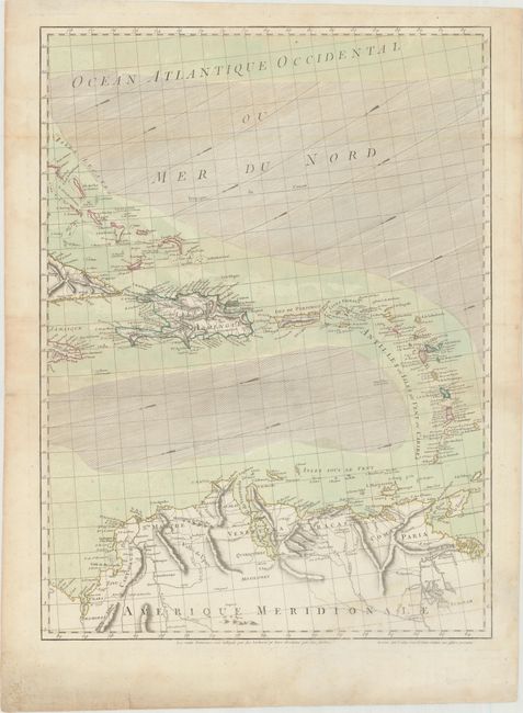
This wall-sized map of the Gulf of Mexico and Caribbean gives excellent detail both on land and at sea. There is dense information on topography, rivers, and cities throughout Mexico and Central America, with less information within the southern US. Within present-day Texas is a notation regarding the presence of cannibalistic Native Indians: "Atacapa ou Antropophages Indiens errans." The trade winds are shown with hachures and arrows, and there is great detail of all the islands in the Caribbean. The cartography is quite accurate for the time period, although the Yucatan Peninsula is too narrow at its base, and Baja California extends too far east at its tip. Printed on three separate sheets, each chart stands on its own with complete borders (size given is for each sheet). This is the third state, published by Delamarche.
References: Sellers & Van Ee #1703; cf. Lowery #648.
Condition: B+
Fine impression and original color with full wide margins. Folded, as issued. There are a couple of faint damp stains, including a small one adjacent to the title cartouche and a larger one just entering Venezuela at bottom right, as well as some minor toning along the top fold on the third sheet. There are a couple of minor repaired tears and soil in the blank margins, else very good. The first image is a composite image - this map is in 3 separate sheets.