Catalog Archive
Auction 170, Lot 364

"A Map of the West-Indies &c. Mexico or New Spain. Also ye Trade Winds, and ye Several Tracts Made by ye Galeons and Flota from Place to Place", Moll, Herman
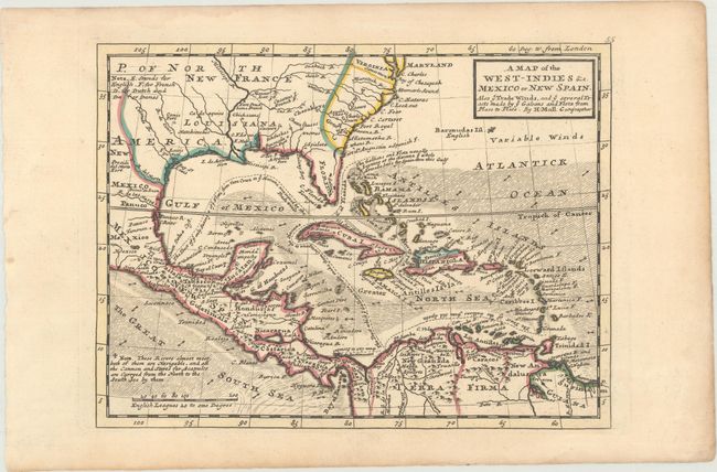
Subject: Gulf of Mexico & Caribbean

Period: 1729 (circa)

Publication: Atlas Minor

Color: Hand Color

Size:
10.4 x 7.8 inches
26.4 x 19.8 cm
Download High Resolution Image
(or just click on image to launch the Zoom viewer)

Terrific copper engraved map covering the southern part of the United States, Mexico, Central America, the Caribbean and northern South America. Florida is shown as a stubby peninsula and the Gulf Coast cartography is still a bit confused. Locates Charlestown in the huge Carolina which includes Georgia. The map is filled with fascinating notations concerning the movements of Spain's wealthy galleons. Their route took them into British waters off the coast of Florida and Carolina. The seas are fully engraved with the directions of trade winds added. Simple rectangular title cartouche.

References: cf. Manasek #69.

Condition: A

A crisp impression with contemporary outline color and light toning along the edges of the sheet.

Estimate: $275 - $350

Sold for: $200

Closed on 11/14/2018

Archived