Subject: North Carolina, Geology
Period: 1875 (published)
Publication:
Color: Hand Color
Size:
27.3 x 14 inches
69.3 x 35.6 cm
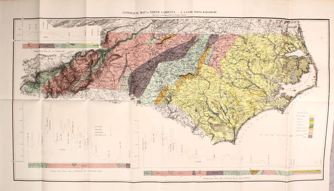
Although North Carolina established the first publicly funded geological survey in America in 1824, it was not until this report (some 50 years later) that the state published its first geological map. Compiled by State Geologist W.C. Kerr, the detailed map is color-coded to show eight different geological types including Cretaceous, Triassic, and Huronian among others. Surrounding the map are three detailed cross sections/topographic profiles of different parts of the state. The base map was provided by the U.S. Coast Survey.
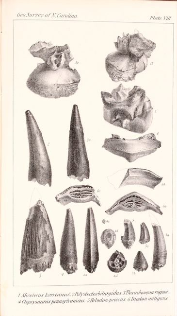
The map is still bound into the front of the volume, which includes 445 pages of total text, 9 black & white plates, folding geological map, and other in-text illustrations. First edition. Octavo, bound in later quarter leather with tips over marbled boards and gilt titling on spine.
References: Marcou & Marcou #593.
Condition: B+
The map has light scattered foxing, faint color offsetting, and a short binding tear at right that has been closed on verso with archival tape. Text is very good with occasional scattered foxing. Covers have light wear with bumped edges.