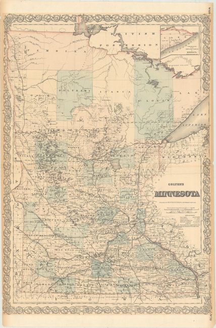
Subject: Minnesota
Period: 1867 (dated)
Publication: General Atlas
Color: Hand Color
Size:
17.1 x 24.3 inches
43.4 x 61.7 cm
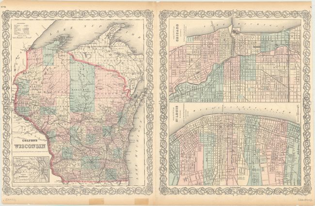
This finely engraved double page map of the state includes an inset of the north-eastern portion at upper right. It is very detailed with identification of regions, important cities, rivers, lakes, mountain ranges, and railroad lines. Development is quite dense in the lower half of the state, tapering off to virtual wilderness in the north. A tangled of named railroads, both completed and proposed, fill the lower half with one running along the western boundary all the way to the St. Vincent near the Canadian border where it crosses the Red River. Colton's decorative borders were added to the map in the General Atlas as of the 1860 edition. The verso features plans of St. Louis and Chicago and a map of Wisconsin.
References:
Condition: B+
There are 1" centerfold separations at left and right, light toning mostly confined to the sheet's edges, and a hint of offsetting. Two short edge tears that just touch the border at left have been closed with cello tape on verso.