Catalog Archive
Auction 170, Lot 270

"Carte Geographique, Statistique et Historique de Massachusetts", Buchon, Jean Alexandre

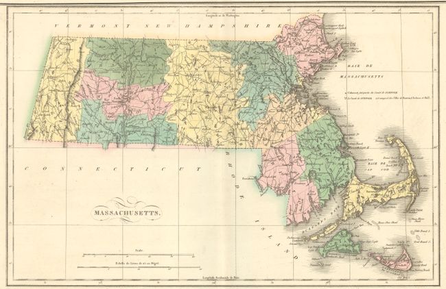
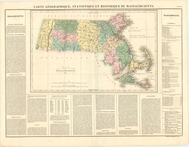
Subject: Massachusetts

Period: 1825 (published)

Publication: Atlas Geographique, Statistique, Historique ... des Deux Ameriques

Color: Hand Color

Size:
17.8 x 11.5 inches
45.2 x 29.2 cm
Download High Resolution Image
(or just click on image to launch the Zoom viewer)

This map is from the French edition of Carey & Lea's American Atlas, with French text surrounding the map on three sides of the large folio sheet. It is a beautiful map of the state with counties, roads, and towns all well delineated. County configuration is current to 1821, just after Maine gained its statehood from Massachusetts in 1820. The surrounding text includes information on topography, climate, and major cities, population figures by county, and a list of governors from John Carver to John Brooks. Buchon's maps were printed on better quality paper than their American counterparts. Overall size, including text, is 24.8 x 18.4".

References: Phillips (Atlases) #1176-16.

Condition: A

Original color.

Estimate: $160 - $190

Sold for: $120

Closed on 11/14/2018

Archived