Subject: Colorado, Railroads
Period: 1906 (dated)
Publication:
Color: Printed Color
Size:
33.6 x 28.7 inches
85.3 x 72.9 cm
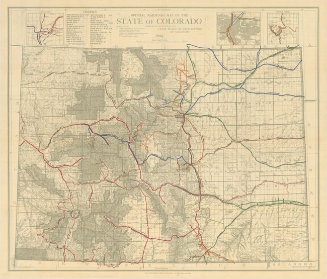
This large, railroad map of the state was compiled by A.F. Dinsmore under the direction of the State Board of Equalization of Colorado. It details an impressive 31 different railroads throughout the state with standard gauge lines indicated by a thick overprinted line and narrow gauge lines shown with a thin line. The proposed Missouri Pacific Railway is depicted in the southeastern part of the state, as well as the proposed Denver Northwestern and Pacific Railway in the northwest. Includes insets maps of Denver, Leadville, and Cripple Creek at top. Issued on thin, banknote-style paper by the Smith-Brooks Press in Denver.
References:
Condition: A+