Subject: Colonial North America
Period: 1775 (dated)
Publication:
Color: Hand Color
Size:
45.8 x 19.8 inches
116.3 x 50.3 cm
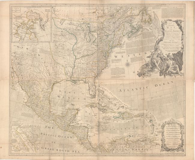
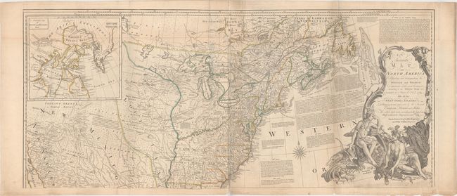
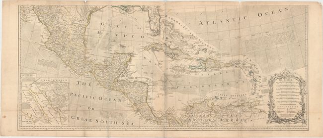
This is an earlier edition of this large, influential map that had a long and varied publishing history. Originally published to illustrate the seat of the French and Indian War, the map went through numerous revisions and editions to document the expanding cartographic knowledge and political landscape of North America. This is the fourth state (of 12) of the map per Steven and Tree's compilation with Robert Sayer's imprint at bottom. The title was changed to eliminate the mention of the French Dominions. It incorporates several alterations in the Hudson Bay region and shows an early depiction of Lake Ouinipigon or Winipick. The map provides an extremely detailed view of the continent just prior to the American Revolution. It locates hundreds of settlements and Indian villages and is filled with interesting notations referring to native tribes and historical events. A number of roads are shown on the map stretching all the way to New Mexico and New Navaar. There are two interesting inset maps. One shows the discoveries of Father Eusebius Kino in the Southwest that proved that California was not an island. The other illustrates the ongoing search for a Northwest Passage, showing Baffin and Hudson Bays with the fictional Lake de Fonte reaching nearly to Baffin Bay. The text of several articles of the Treaty of 1763 are engraved in the Atlantic Ocean. It is embellished with a bold title cartouche featuring Native Americans and indigenous animals. Printed on four sheets, joined into two horizontal pairs, as issued.
References: Stevens & Tree (MCC-39) #49d.
Condition: B
Issued folding on watermarked paper with original outline color. There are a number of small fold separations with some small loss of image primarily at the junctions. Both sheets have light toning and minor printer's ink residue. The first image is a composite image that shows what the map would look like if it were completely joined; the map is only joined in two horizontal pairs.