Subject: Western Hemisphere - America
Period: 1678 (circa)
Publication:
Color: Hand Color
Size:
22.8 x 19.3 inches
57.9 x 49 cm
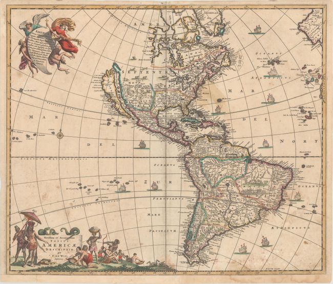
This is a close derivative of Nicolas Visscher's influential map of the Americas. However, the island of California and the Great Lakes are shown on the Sanson model. In the Southwest, the Rio del Norto flows from a large interior lake and empties into the sea between the mainland and California. In South America, the mythical lakes Parime Lacus and Xarayes are prominent, and a battle scene and village appear in the Brazilian interior. The map is embellished with two large cartouches that were also copied from Visscher. In the top left corner, one cartouche depicts angels struggling with a devil for the soul of a Native American. At bottom left, the pictorial title cartouche contains scenes of gold panning, hunting, and a native chief standing beneath an umbrella. The only change De Wit made was that the chief is standing on the left rather than on the right as in Visscher's composition. This is the third state, the last state with decorative sailing ships in the seas.
References: Burden #465; McLaughlin #49; Tooley p. 120 #30; Wheat [TMW] #52.
Condition: B
There is scattered foxing that is more prominent in the lower third of the sheet and a stain off the east coast of North America. A few small centerfold separations have been closed on verso with archival materials, and the sheet has been remargined at bottom.