Subject: India, Bangladesh
Period: 1760 (circa)
Publication: London Magazine
Color: Black & White
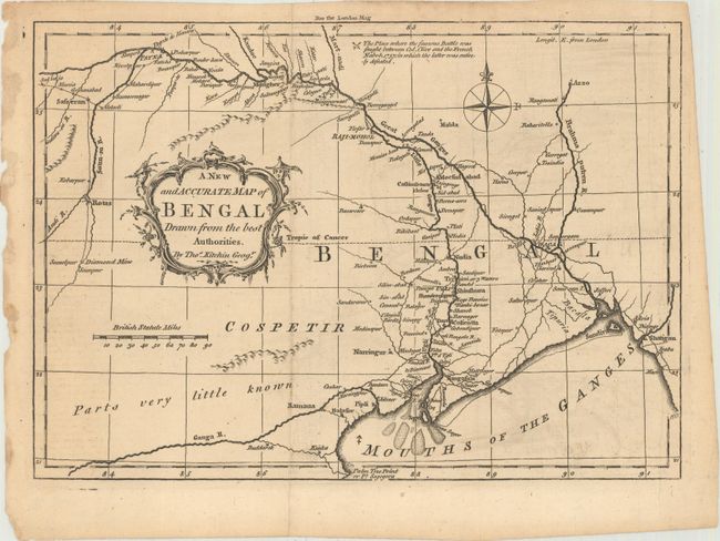
A. A New and Accurate Map of Bengal Drawn from the Best Authorities (10.1 x 7.1"). This attractive map shows the Ganges River flowing through Bengal to Daca (Dhaka) and thence to its mouth at the Bay of Bengal. It also shows the Little Ganges River, more commonly known as the Hooghly River, flowing southward through Shinshura, Colicotta (Calcutta), and Rangasula. The southern region of Bengal is labeled "parts very little known." Published in February 1760, and engraved by Thomas Kitchin, one of England's premier engravers. Condition: A dark impression issued folding with minor offsetting.
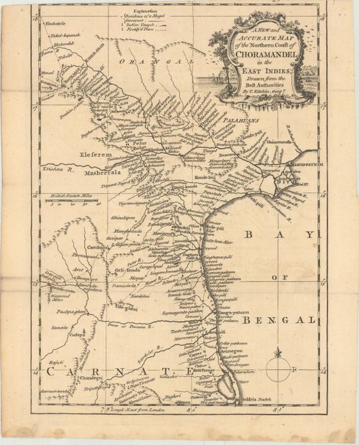
B. A New and Accurate Map of the Northern Coast of Choramandel in the East Indies; Drawn from the Best Authorities (6.9 x 9.6"). This handsome map depicts a stretch of the Coromandel Coast in southeastern India. It extends from the mouths of the Krishna River south to Pulicat Lake. There are numerous place names and good detail of the region's mountains and rivers. A key at top identifies the residences of Mogols and governors, Indian temples, and fortifications. There is a decorative title cartouche adorning the top right corner. Condition: Issued folding with faint offsetting and a few minor spots. The top margin has been trimmed past the neatline, with part of the border missing.
References: Jolly #LOND-182 & 187.
Condition: B+
See description above.