Subject: Ancient World
Period: 1550 (published)
Publication:
Color: Black & White
Size:
3.1 x 3.1 inches
7.9 x 7.9 cm
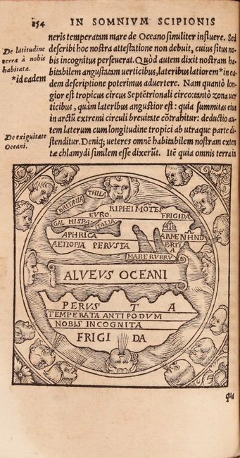
This work, written by Ambrosius Macrobius, is a commentary on Cicero's Dream of Scipio. It includes a rare woodcut map of the world (3.1 x 3.1") illustrating Cicero's interesting theories. This diagrammatic map shows two distinct regions of the earth. The inhabited Afro-Eurasian continent was balanced by an unknown, and relatively equal, landmass (Temperata Antipodum Nobis Incognita) on the other side of an impassable torrid zone (Perusta) and a great boiling sea (Alveus Oceani). It was this notion of antipodean balance and landmass equivalence that continued to attract Renaissance minds to the otherwise outmoded geographical ideas of Macrobius. Distinguished cartographers like Mercator and Ortelius would later incorporate Macrobius' model into an immense southern continent (Australis Incongita) to balance the known lands of the world, and the division of the world into climactic zones is still in use today. According to King, this example of the ancient world is the 5th version, published by Sebastian Gryphius in Lyons.
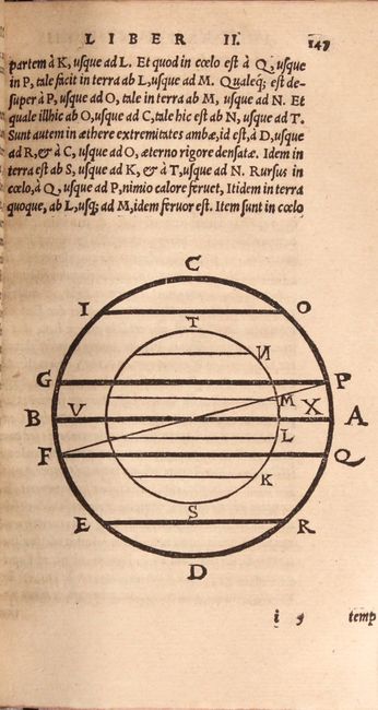
Macrobius was a 5th century Roman neoplatonic philosopher. His commentary on Cicero’s Somnium Sciponis was of great influence in the Middle Ages and gained popularity with the advent of printing. First published in Brescia in 1483, numerous editions appeared throughout the 16th century. His commentary includes several chapters dealing with his own conception of the world and the universe. It also contains references to many facets of the scientific knowledge of his time, including references to physics, astronomy, and mathematics. 12mo, 567 pp. and extensive index. Hardbound in marbled paper-covered boards with four raised bands and paper title labels on spine.
References: Shirley #13; King (2nd ed.) pp. 34 & 193-4; Moecker (MapForum #4), pp. 26-30.
Condition: B+
Light toning and minor soiling, with a light damp stain that affects the fore-edge of the last 100 pages of the book. The binding is tight, and there are some cracks and light wear along the spine.