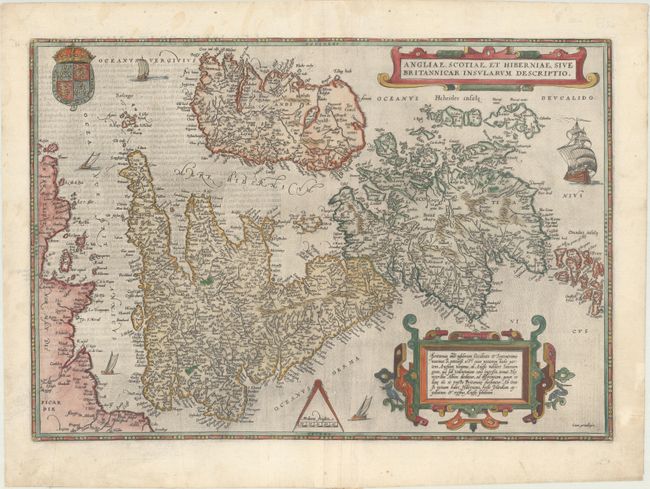
Subject: Britain
Period: 1581 (published)
Publication: Theatrum Orbis Terrarum
Color: Hand Color
Size:
19.7 x 13.7 inches
50 x 34.8 cm
This map, based on the cartography of Gerard Mercator, is Ortelius' earliest map of Britain. Flemish influence, or possibly a mistranslation, is evident in the rendering of some of the place names, e.g. Ormyskyrk for Ormskirk, Dantre for Daventry, and the omission of the relatively important Peterborough. Distinguished by a sophisticated style of engraving, the map is embellished with two ornate strapwork cartouches, the royal coat of arms of the UK, dividers and distance scale and five sailing ships. French text on verso.
References: Shirley (MCC-94) #86, pl. 42; Van den Broecke #16.
Condition: B+
A dark impression with light printer's ink residue, some stains in the blank margins, and a professionally repaired tear that enters 3" into image at bottom left.