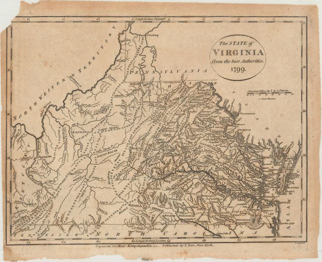
Subject: Virginia
Period: 1799 (dated)
Publication: New Encyclopaedia
Color: Black & White
Size:
9.9 x 7.4 inches
25.1 x 18.8 cm
Early map of the state that is finely engraved and filled with detail. The map shows terrific detail of watershed, many towns and villages, wagon roads and trails, counties and court houses. The Northwest Territory lies just across the Ohio River border. The map was derived from John Reid's map for the American Atlas, which in turn was taken from Carey's 1794 folio map. Published by John Low, New York, and engraved by Alexander Anderson (1775-1870). Originally appeared in Payne's New and Complete Universal Geography, also published by Low.
References: cf. Wheat & Brun #574.
Condition: B
A dark impression with a small chip at top left with a small portion of the border missing. There is light toning and scattered foxing.