Subject: South Carolina
Period: 1801 (published)
Publication: Carey's American Pocket Atlas
Color: Hand Color
Size:
7.6 x 5.8 inches
19.3 x 14.7 cm
Mathew Carey was a seminal figure in early American publishing; establishing the first publishing firm to specialize in cartography and issuing the first atlas devoted exclusively to American maps. He set up an elaborate cottage system of craftsmen for compiling, engraving, printing, and coloring maps. This practice was emulated by later American cartographic publishers such as John Melish and Henry S. Tanner. The American Atlas concept was also adopted by other publishers in both the United States and Europe.
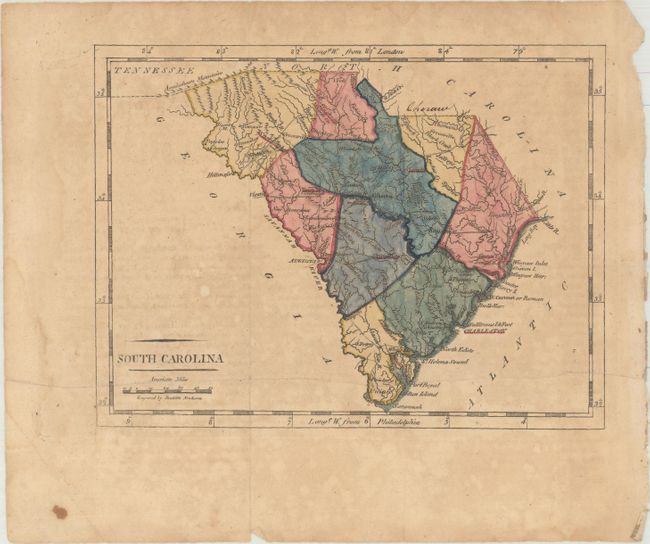
This is the second state of this delicately engraved map of the Palmetto State with the addition of roads and new place names. It details topographical features, watershed, towns, and villages. As is typical of maps of South Carolina from this era, the state appears in a strange, elongated shape due to the use of an exaggerated north and south scale. Four Holes Swamp is identified north of Charleston, and there are two Greenvilles, one above Black Creek, the other below Reedy River. Engraved by Doolittle.
References: Wheat & Brun #603.
Condition: B
Issued folding with light toning and faint foxing. There is a horizontal printer's crease that runs the length of the map, and faint offsetting from an opposing page of text. A single manuscript notation runs along the North Carolina/South Carolina border.