Subject: Eastern United States
Period: 1816 (published)
Publication: An Elementary Treatise on Mineralogy and Geology...
Color: Hand Color
Size:
10.9 x 9.1 inches
27.7 x 23.1 cm
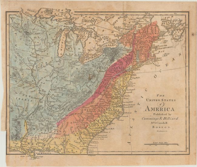
This early geological map was included in Parker Cleaveland's first edition of An Elementary Treatise on Mineralogy and Geology. The map covers the eastern United States, extending past the Mississippi River to include Louisiana and New Iberia. Florida is divided into East and West, with New Orleans located in West Florida. The map uses hand coloring to depict five or six geologic classifications, though no key exists (the classifications are described in Cleaveland's report - not included). The map is not listed in Marcou, but it appears to be very similar to William Maclure's first geological map published in 1809. Cleaveland's second edition map (1822) is listed as Marcou #28 and states that the map is a reissue of Maclure's 1817 map "with very few additions or variations." Only 1,000 copies of the first edition of Cleaveland’s book were printed and were quickly exhausted, necessitating a second edition.
References: cf. Marcou & Marcou #28.
Condition: B
Issued folding with light toning and scattered foxing. A small edge chip that just extends into the border at left has been reattached with non-archival tape on verso.