Subject: Atlases
Period: 1770 (published)
Publication:
Color: Hand Color
Size:
2.7 x 4.7 inches
6.9 x 11.9 cm
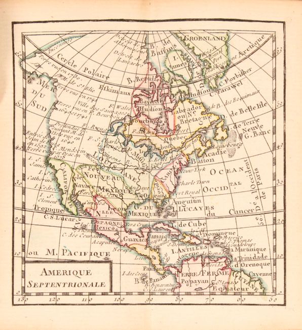
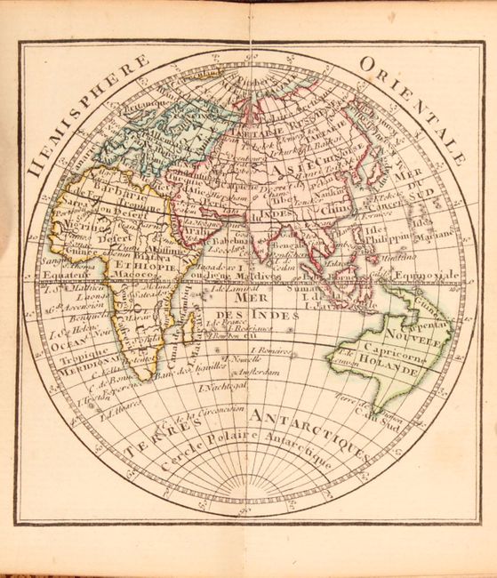
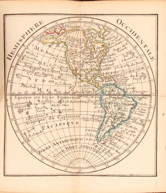
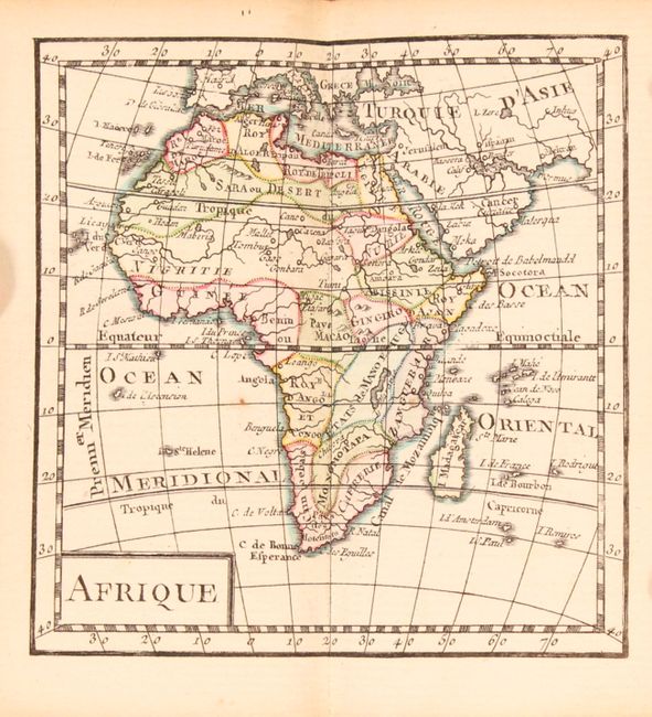
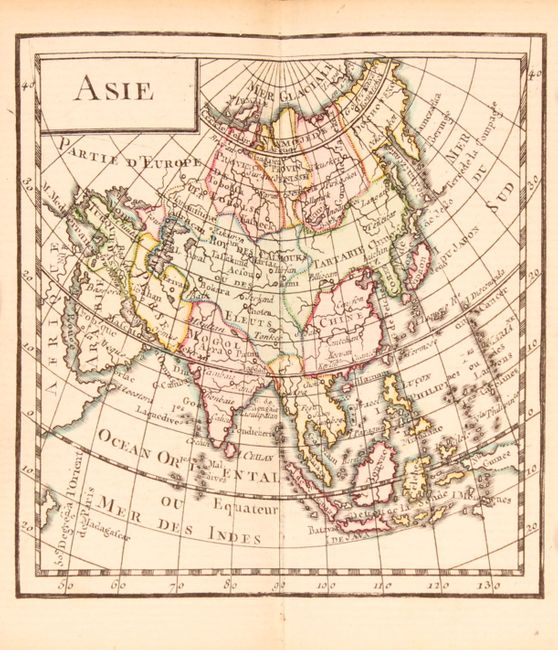
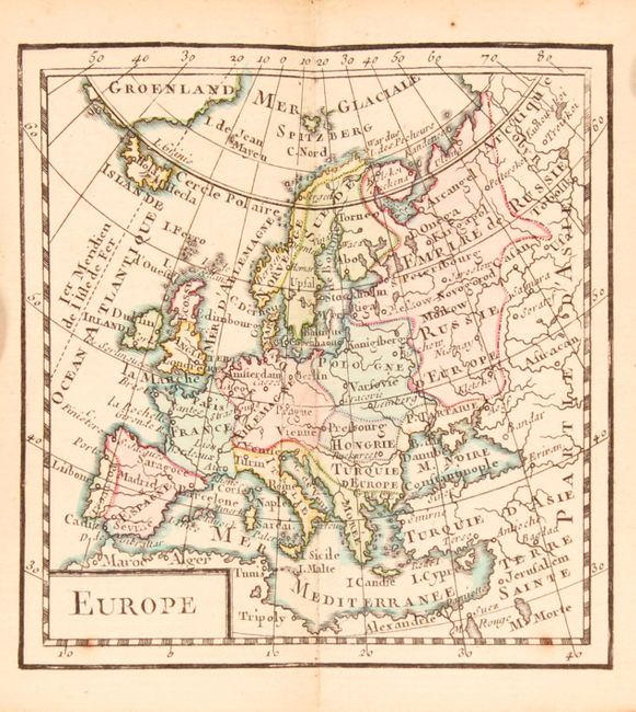
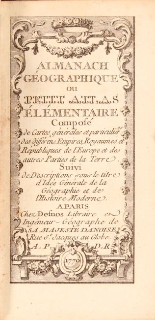
This remarkable miniature atlas includes 17 double-page maps: western hemisphere, eastern hemisphere, North America, South America, Europe, Asia, Africa, and ten maps of countries in Europe. The tiny map of North America contains a great deal of information, with a number of small notes on various discoveries. Geographically, rivers, key political boundaries, and the locations of forts are shown. The entire eastern seaboard is labeled Caroline, the Florida peninsula is truncated, and the northern coast of Alaska is labeled inconnues (unknown). The map of the eastern hemisphere shows Nouvelle Hollande attached to both New Guinea and Tasmania. The atlas includes a chapter on the perpetual calendar and another chapter on general geography. The atlas is dedicated to Christian VII, King of Denmark and Norway, whose portrait is included after the title page. Desnos' Almanach Geographique was published with 32 maps, often bound in 2 volumes. This is the first volume with the more desirable maps of the hemispheres and continents.
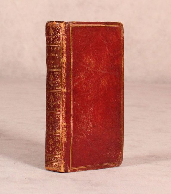
32mo, title page, portrait, [8] pp., i-xxviii, [16] pp., 144 pp. Hardbound in original maroon leather with gilt tooling on covers and spine, a.e.g.
Louis Charles Desnos (1725-1805) was an important instrument, globe and map maker in Paris during the eighteenth century. In addition to his publishing work aimed at the French market, Desnos also held the position of Royal Globe maker to the King of Denmark. He worked with several other publishers including Zannoni and Louis Brion de la Tour and produced a great many cartographic works including numerous atlases and a series of decorative wall maps.
References: King (2nd Ed.) p. 176.
Condition: A
he maps are clean and bright with original color. The eastern hemisphere map has a tiny tear confined to the left blank margin, and the western hemisphere map has a tiny tear that just enters the map image at right. There is a small stain that affects the front free-endpapers. The binding is tight and the covers show minor wear. Engraved bookplate of previous owner (Edward Green) on front pastedown.