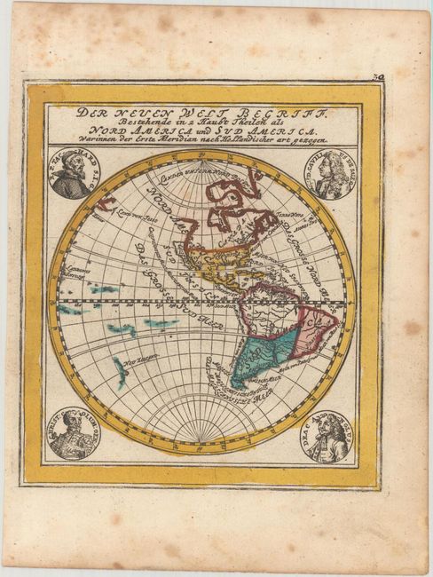
"Der Neuen Welt Begriff Bestehende in 2 Haubt Theilen als Nord America und Sud America, Warinnen der Erste Meridian nach Hollandischer art Gezogen", Stridbeck/Bodenehr
Subject: Western Hemisphere - America
Period: 1700 (circa)
Publication:
Color: Hand Color
Size:
5.2 x 5.8 inches
13.2 x 14.7 cm
Attractive small map of the Americas surrounded by medallion portraits of famous explorers. The map features the Island of California (based on Sanson) and shows the northwest coastline of North America extending well north, and bending northeast of California. Hudson Bay is delineated but there is no waterway to the west of that bay, and there is a single, open-ended lake in the Great Lakes region. There are a few small islands in the Pacific in addition to part of the coastline of New Zealand. This is the first state of the plate.
References: McLaughlin #141.
Condition: B+
Light scattered foxing that is mostly confined to the blank margins.