Catalog Archive
Auction 168, Lot 653

"Premiere Partie de la Carte d'Asie Contenant la Turquie, l'Arabie, la Perse, l'Inde en deca du Gange et de la Tartarie...", Anville, Jean Baptiste Bourguignon d'

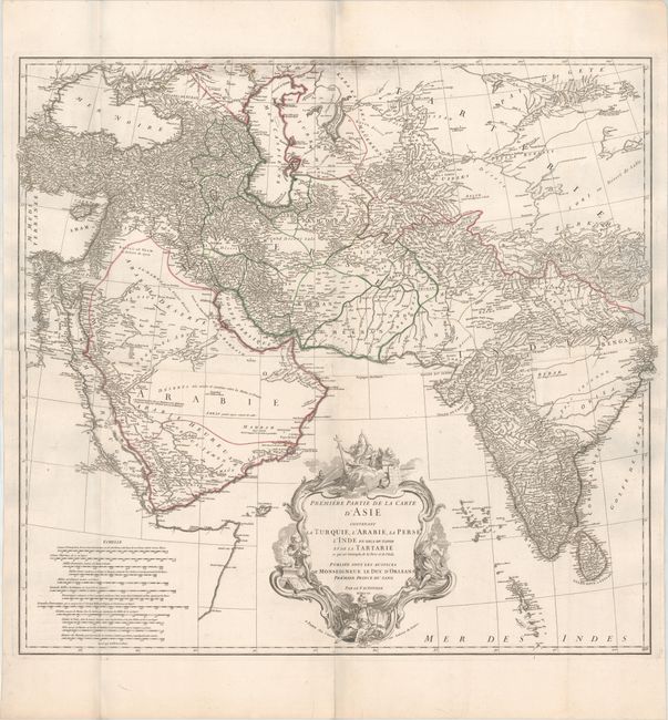
Subject: Southern Asia

Period: 1751 (dated)

Publication:

Color: Hand Color

Size:
31.2 x 29 inches
79.2 x 73.7 cm
Download High Resolution Image
(or just click on image to launch the Zoom viewer)

This large map of Southwestern Asia extends from Turkey and the Arabian peninsula in the west, to Tibet and all of India in the east. There is fine detail throughout Turkey, Iraq, Iran, and much of India, whereas the Arabian peninsula and areas east of the Caspian Sea are left largely blank. Tibbetts considers this map "the first really modern map of Arabia." A very large title cartouche fills the entire Arabian Sea and incorporates three Asian figures and numerous religious symbols. The cartouche was drawn by H. Gravelot and engraved by De Lafosse. The map was engraved by Guillaume Nicolas Delahaye. Printed on two sheets, joined.

References: Tibbetts #281.

Condition: A

A fine impression on watermarked paper with a bit of printer's ink residue along the top border. Issued folding.

Estimate: $1,000 - $1,300

Sold for: $560

Closed on 6/6/2018

Archived