Subject: Germany
Period: 1711 (circa)
Publication: Atlas Geographicus
Color: Hand Color
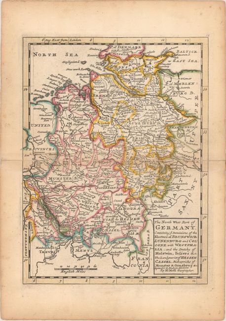
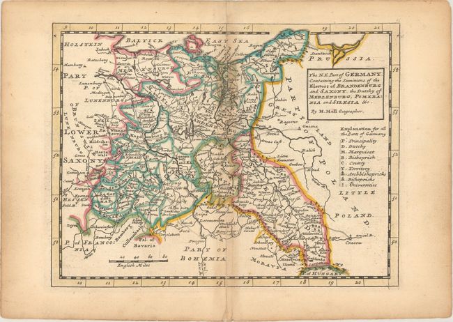
A nice group of maps focused on Germany that was issued in Moll's Atlas Geographicus: Or, A Compleat System of Geography. The map of northeast Germany contains the key for all three maps and identifies Principalities, Dutchies, Counties, Bishopricks, Universities and more. Moll's imprint is contained within the block-style title cartouche.
A. The North West Part of Germany. Containing ye Dominions of the Electors of Brunswick Lunenburg and Cologne with Westphalia... (7.7 x 10.3"). Condition: A long centerfold separation has been repaired on verso with old paper. (B)
B. The N.E. Part of Germany. Containing the Dominions of the Electors of Brandenburg and Saxony... (10.2 x 7.7"). Condition: There is light staining along the centerfold at top and a small centerfold separation at bottom has been repaired on verso with old paper. (B+)
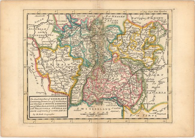
C. The South West Part of Germany: Containing ye Dominions of ye Archbishops and Electors of Mentz & Treves; and of ye Elec: Palatine of ye Rhine... (10.2 x 7.8"). Condition: There is light staining along the upper centerfold and two tiny pinholes only visible when held to light. (B+)
Herman Moll was one of Britain's most prominent cartographers of the first half of the 18th century. He emigrated from Germany and went to work as an engraver for Moses Pitt in 1678. Soon he joined one of London's most interesting social circles, which gathered at Jonathan's Coffee House, and included stock speculators, scientists, archaeologists, authors, pirates, and sea-captains. From these friends, Moll gained a great deal of privileged information that he compiled into his cartographic works. Moll's success and prosperity was due in part to his social connections and political astuteness, and to his distinctive style and quality workmanship. He produced a great number of often-innovative maps, charts, globes, atlases and geographies.
References: Shirley (BL Atlases) T.MOLL-3a #22, 23 & 25.
Condition:
Original outline color. See description above for additional details.