Subject: England
Period: 1720 (circa)
Publication: Britannia Depicta...
Color: Black & White
Size:
3.9 x 7.1 inches
9.9 x 18 cm
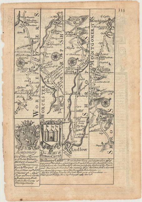
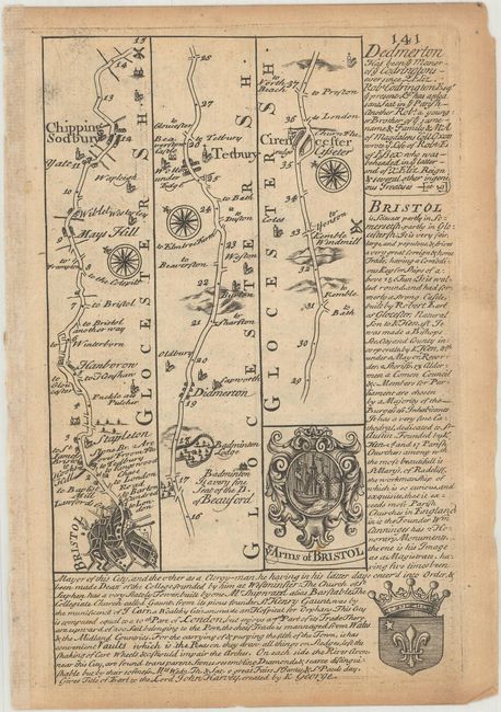
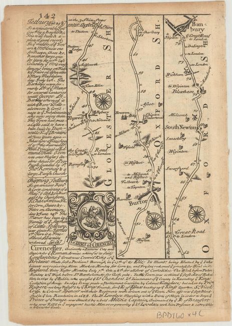
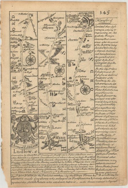
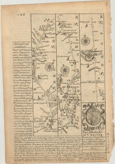
Britannia Depicta Or Ogilby Improv'd was the most popular and successful Ogilby derivative atlas, published in response to public demand for a small road atlas that could be easily carried by travelers. The atlas reproduced Ogilby's strip-style road maps and added individual county maps. It was published by Thomas Bowles in a series of editions between 1720 and 1764. The historical notes that accompany each map were compiled by John Owen, a respected lawyer and antiquarian. The maps were engraved by Emanuel Bowen who went on to become one of London's leading engravers and print sellers in the 18th century. The maps are embellished with coats of arms and contain immense detail and topographical information. A compass rose orients each map and useful landmarks include hills, bridges, rivers and streams, windmills, churches, markets, parks and forests, water wells and even gallows.
These copper engraved, Ogilby-style strip road maps include coats-of-arms and descriptive text by John Owen.
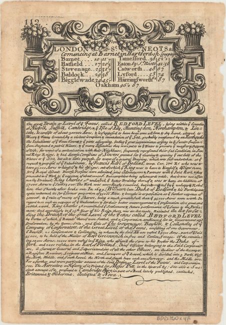
A. [The Road from London to Montgomery...] / [The Road from London to St. Neots...] From Worcestershire through Shropshire into Montgomeryshire, with a page of text describing Old Bedford River and the Fens.
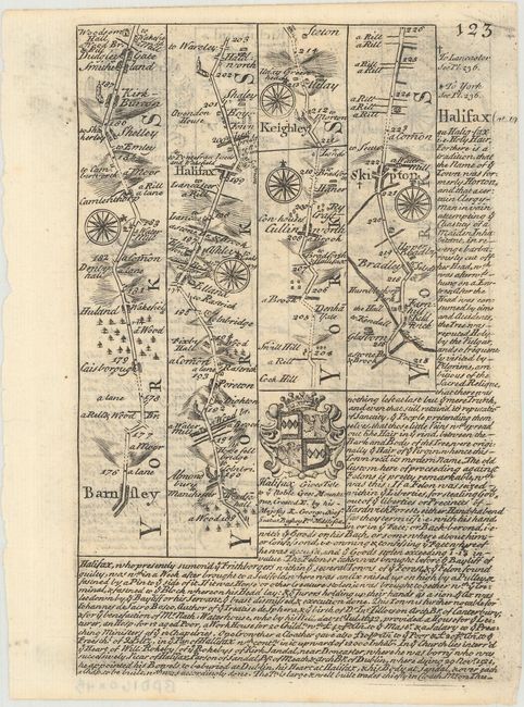
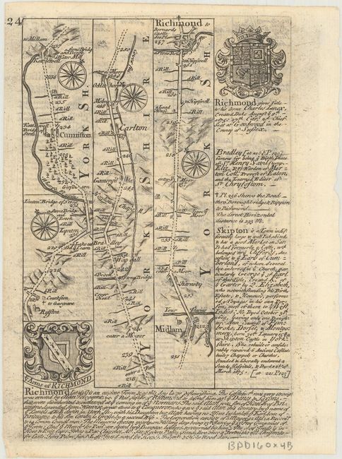
B. [The Road from London to Oakham...] From Barnsley to Richmond.
C. [The Road from Bristol to Banbury...] From Bristol to Banbury.
D. [The Road from Bristol to Westchester...] From Herefordshire to Shrewsbury.
References: Shirley (BL Atlases) T.BOW-1a.
Condition: B+
Some light toning and short edge tears.