Catalog Archive
Auction 168, Lot 413

"Chart of North Atlantic Ocean with Tracks of the Shipping to West Indies, North America &cc.", Thomson, John

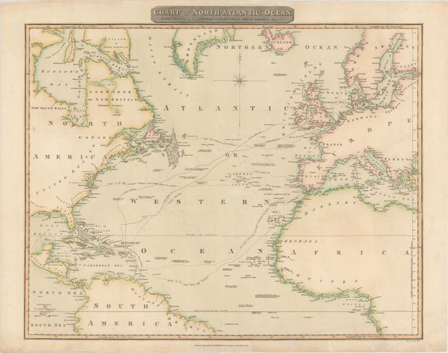
Subject: North Atlantic

Period: 1815 (dated)

Publication: A New General Atlas

Color: Hand Color

Size:
24.8 x 19.6 inches
63 x 49.8 cm
Download High Resolution Image
(or just click on image to launch the Zoom viewer)

This large chart focuses on the important shipping lanes to North America and the West Indies. Of particular note are the shipping tracks of Nelson to the West Indies in pursuit of the French in 1805, the track from England to Newfoundland, and the tracks of the U.S.S. Insurgent. There are numerous notations regarding navigational hazards and sightings and the coastlines are well charted. Engraved by J. Moffat.

References:

Condition: B+

Nice impression and original color. There are 2 archivally repaired tears extending 2" into the map in the bottom right corner.

Estimate: $220 - $250

Sold for: $160

Closed on 6/6/2018

Archived