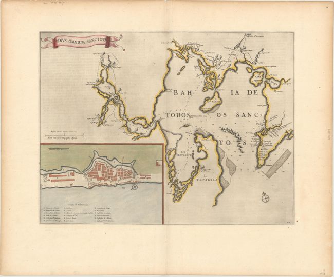
Subject: Todos os Santos Bay, Brazil
Period: 1663 (published)
Publication: Le Grand Atlas
Color: Hand Color
Size:
19.9 x 15.3 inches
50.5 x 38.9 cm
Impressive copper engraving of Todos os Santos Bay (All Saints Bay) in northeastern Brazil. The map depicts a large fleet of Dutch ships entering the bay and locates several battle sites. The map illustrates the region when the Dutch were attempting to gain control of the Portuguese colonies in Brazil and her lucrative sugar trade. In 1624 the Dutch captured and sacked the Salvador da Bahia, and held it along with other northeast ports until it was retaken by a Spanish-Portuguese fleet. The city then played a strategically vital role in the Portuguese-Brazilian resistance against the Dutch in the 1630s. Large inset plan of Civitas S. Salvatoris (San Salvador). The map is adorned with a ribbon-style title cartouche and two compass roses. This is the first edition of this comparatively uncommon map that only appeared in the Americas volume of Blaeu's final atlas between 1662 and 1672. French text on verso.
References: Van der Krogt (Vol. II) #9855:2.2.
Condition: A
A dark impression on watermarked paper with very wide margins, light printer's ink residue, and light toning along the edges of the sheet.