Catalog Archive
Auction 168, Lot 372

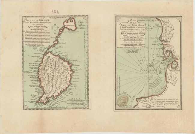
"Isle de la Grenade l'une des Antilles Francoises en Amerique [on sheet with] Plan de la Rade du Fort Royal a l'Occidt. de l'Isle de la Grenade l'une des Antilles Francoises...", Buache, Philip

Subject: Grenada

Period: 1747 (dated)

Publication:

Color: Hand Color

Size:
13.8 x 8.1 inches
35.1 x 20.6 cm
Download High Resolution Image
(or just click on image to launch the Zoom viewer)

This rare sheet includes a map of Grenada and a chart of the Bay of Port Louis, now known as St. George's Bay. The map of Grenada is much too wide and the Grenadine islands to the north are also exaggerated. However the cartography is much improved from Delisle's 1717 map of the island, as noted in the title cartouche, which portrayed the island upside-down with "consequences for navigation." Engraved by Desbruslins.

References:

Condition: B+

Full contemporary color, issued folding on paper with a bunch of grapes watermark and light toning and soiling.

Estimate: $275 - $350

Sold for: $200

Closed on 6/6/2018

Archived