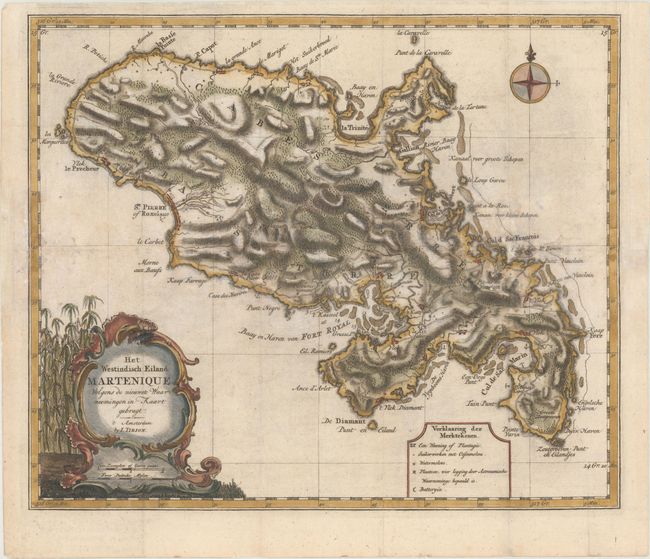
Subject: Martinique
Period: 1769 (circa)
Publication: Hedendaagsche Historie...
Color: Hand Color
Size:
14.4 x 12.1 inches
36.6 x 30.7 cm
A finely engraved, decorative map of the island divided into three districts and filled with tremendous detail of roads, topography, soundings, villages, windmills, and plantations. The title cartouche incorporates the distance scales and is garnished with sugar cane. A compass rose completes the composition. Tirion's Hedendaagsche Historie was initially conceived as the Dutch edition of Thomas Salmon's Modern History. The work began in 1729, but the text was later expanded and the Hedendaagsche Historie was therefore not completed until 1803.
References: Shirley (BL Atlases) G.TIR-1a #20.
Condition: B
Issued folding and now flattened with some minor extraneous creasing, light soiling, and professional repairs to several small holes and tears along the folds, as well as to some small worm holes in the image, with minor loss of image.