Subject: Southwestern United States & Mexico
Period: 1857 (circa)
Publication: Black's General Atlas
Color: Hand Color
Size:
14.8 x 10.3 inches
37.6 x 26.2 cm
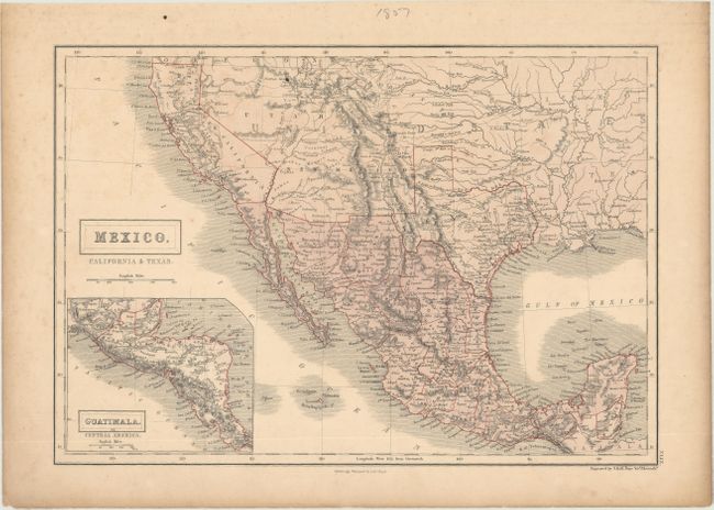
This delicately engraved map depicts Mexico and the region recently acquired by the United States in the Mexican-American War. The map features a post-Gadsden Purchase border between Mexico and the United States. Missions in California dot the route along the coast as far south as Baja. Detail throughout the Southwest and Texas includes forts, roads, towns, and Indian Lands. A great number of towns are located in Texas including Waco Village, Uacosi, Encinos, S. Antonio, Austin, Houston, and Liberty, but there is no sign of Dallas or Fort Worth. The huge Utah Territory stretches between California and Indian Territory. New Mexico Territory is in its largest extent, bounded by Mexico, California, Utah and Texas. The inset map of Central America is titled Guatimala. This lithographed map is a nice example of transitional coloring using a combination of early printed color (Mexico) and outline coloring applied by hand along the boundaries. It was produced in Scotland and finely engraved by Sidney Hall.
References:
Condition: B+
There is light toning, scattered foxing, and a small ink dot next to the Great Salt Lake. A short edge tear in the top blank margin has been repaired on verso with archival tape.