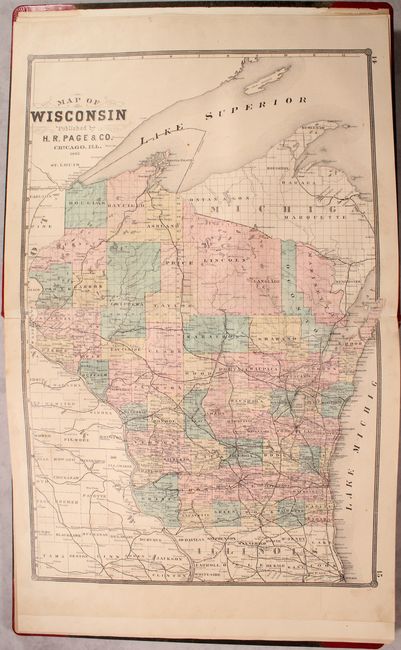
Subject: Wisconsin
Period: 1881 (published)
Publication:
Color: Hand Color
Size:
15.2 x 17.9 inches
38.6 x 45.5 cm
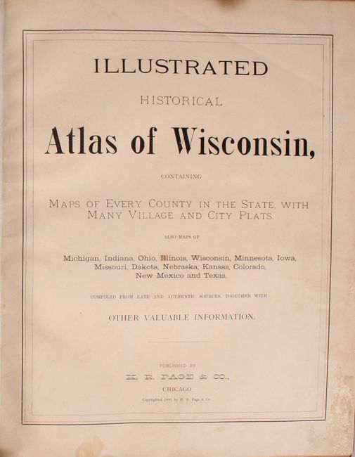
This uncommon atlas was published by the little known H.R. Page & Co. firm of Chicago. The atlas is divided into two sections - the World & United States, and the state of Wisconsin. The first section contains double-page maps of the world, United States, and 14 states/territories including Wisconsin, Michigan, Illinois, Iowa, Minnesota, Ohio, Indiana, Dakota Territory, Missouri, Kansas, Nebraska, Colorado, New Mexico and Texas. Of particular interest in this section are:
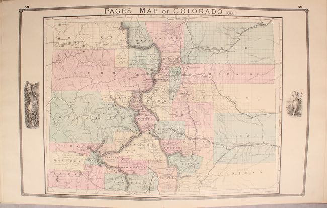
Page's Map of Colorado. This map of the state shows early county development including the immense counties of Arapahoe, Elbert, Bent, Weld and Las Animas in the eastern plains. Several railroads are shown including a branch of the Denver & Rio Grande that extends to Florida in La Plata County. The map locates many towns and mines and provides an excellent view of the topography. Telluride is located but no roads are shown in the area. Some uncommon place names appear including Tennessee Colony near Ft. Morgan and Greeley.
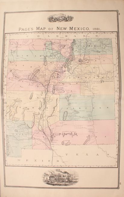
Page's Map of New Mexico. This large map shows only 12 counties and incomplete surveys, with most settlement clustered in the Rio Grande valley and along the railways. It locates a large array of railroads, roads and trails, lakes and rivers.
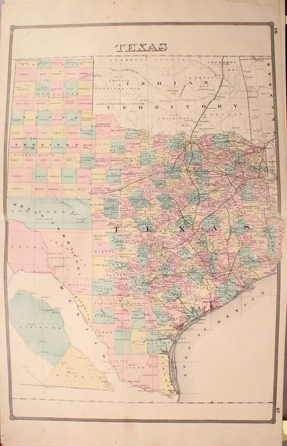
Texas. County development is mostly confined to the eastern half of the state. The map locates cities, towns, rivers, lakes, and an extensive railroad network. A small inset at bottom shows the western counties of Presidio and El Paso upside down in order to fit on the sheet.
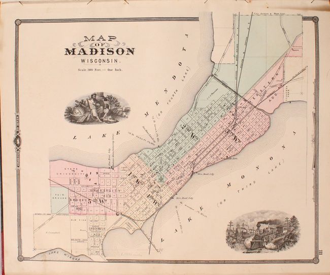
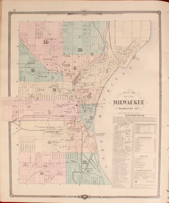
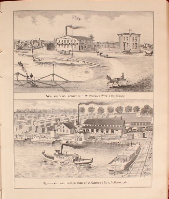
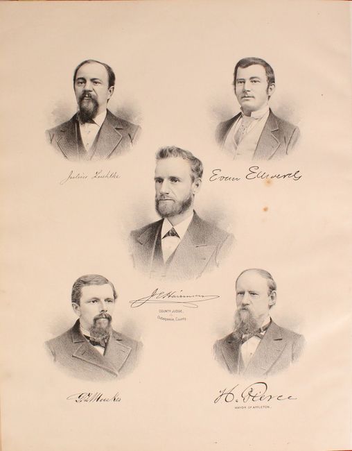
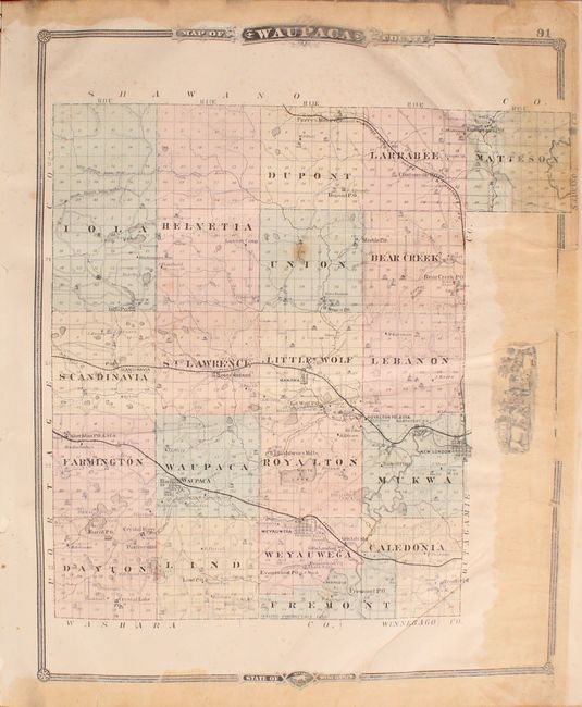
The Wisconsin section includes an impressive 85 single-page and 4 double-page maps of counties and cities in the state. Includes maps of Milwaukee city, Milwaukee County and Madison to name a few. The maps are augmented by many pages of illustrations showing businesses, prominent residences, portraits and scenery. Includes a 37 page "History of Wisconsin" and 7 pages of "Patrons' Business Cards." Rebound in quarter red leather with tips over black cloth with the original gilt front cover title laid down. This is the last, and perhaps most desirable, of the three Wisconsin state atlases published during the period 1875 to 1881.
References:
Condition: B+
The vast majority of the maps range from good to near fine with even light toning and minor soiling. There are several maps that have old repairs, however. The maps of the world and United States have old repairs along the bottom edge of the sheet, just entering the border of the U.S. map. The map of Illinois has an old tape repair on recto to a centerfold separation that enters 2" into the image, and the map of Ohio has a repair on recto to two tears adjacent to the centerfold. Several county maps also have old tape repairs on pages 91-94, 107-110 and 145-148. Text and illustration pages are lightly toned. Hinges are reinforced with binder's tape. Binding has light wear with only minor stains and abrasions on the boards.