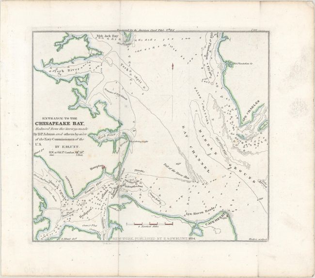
Subject: Chesapeake Bay, Virginia
Period: 1854 (dated)
Publication: American Coast Pilot 17th Edition
Color: Hand Color
Size:
8.1 x 7.2 inches
20.6 x 18.3 cm
Engraved for the 17th edition of The American Coast Pilot, published by E. & G.W. Blunt, this chart details the southern portion of Chesapeake Bay around Hampton. It extends north to show Mob Jack Bay and Old Plantation Flats. The chart identifies Cape Charles, Cape Henry and its lighthouse, Lyn-Haven and Hampton Roads, the York Spit, Back River, and more. It also locates the James, Back, and York Rivers. Soundings and shoals are noted, such as the Tail of the Horse Shoe. Engraved by Hooker.
The American Coast Pilot was a detailed guide to harbors, capes, and headlands on the east coasts of North and South America including information on winds, currents, and tides as well as latitudes and longitudes. The American Coast Pilot was published in 21 editions between 1796 and 1861, until it was replaced by federally-funded charts produced by the US Coast Survey.
References:
Condition: A
Issued folding with a hint of offsetting, a few faint spots of foxing, and a tiny fold separation in the top blank margin.