Subject: Montana
Period: 1876 (published)
Publication:
Color: Black & White
Size:
17.5 x 15.2 inches
44.5 x 38.6 cm
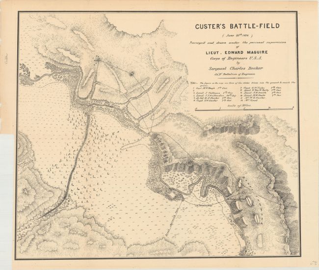
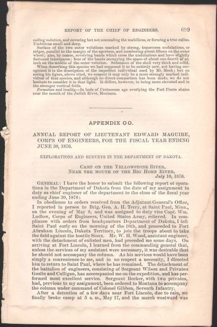
An excellent terrain map of the scene of Custer's defeat that was made shortly after the infamous massacre of the 7th Cavalry. Maguire was attached to a column that came to Reno's rescue and upon departure of the hostile Indians he proceeded to the scene of the disaster. Drawn by Sergeant Charles Becker, the map details the area, locates the graves of 12 fallen soldiers and officers, including Lt. Col. Custer. Locates the Indian Village, the course of the Little Big Horn River, Reno's skirmish line and much more of interest. In his 6 page report that is included with this map, Maguire's comments are most elucidating on several levels, including "The Indians are the best irregular cavalry in the world, and are superior in horsemanship and marksmanship to our soldiers, besides being better armed…" A remarkable map of a most historic event. The map and report are housed in a modern folder.
References: Wheat (TMW) #1266.
Condition: B+
The map, issued folding, is very good with pleasant light toning and a binding trim at lower left. Disbound report is also very good with a faint dampstain confined to the right margin of the text.