Subject: Martha's Vineyard, Massachusetts
Period: 1893-1903 (circa)
Publication:
Color:
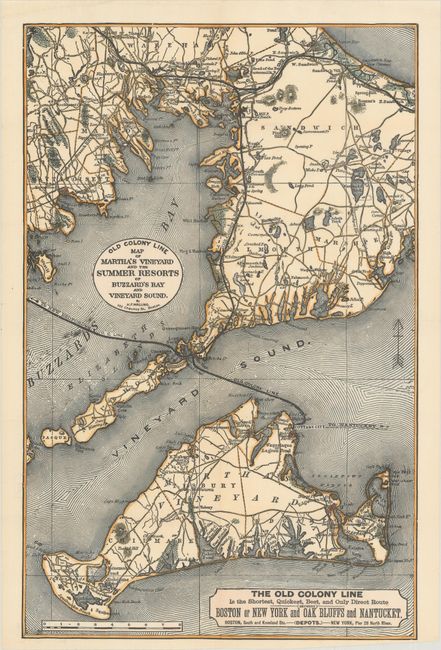
A. Old Colony Line Map of Martha's Vineyard and the Summer Resorts of Buzzard's Bay and Vineyard Sound, by H.F. Walling, circa 1893, hand color (9.1 x 14.1"). An attractive small map covering Martha's Vineyard and a portion of Cape Cod with the Old Colony Line and Old Colony Railroad prominently depicted. Condition: Clean, bright, issued folding. (A)
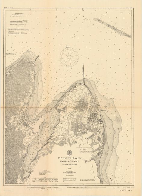
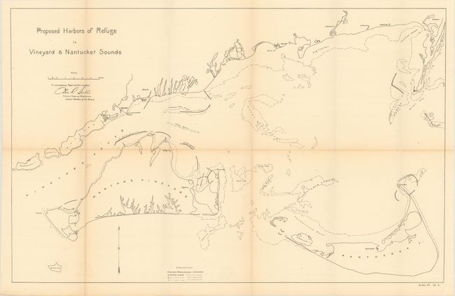
B. [Lot of 2] Vineyard Haven Marthas Vineyard Massachusetts, by U.S. Coast and Geodetic Survey, dated 1903, black & white (13.3 x 17.9") [and] Proposed Harbors of Refuge in Vineyard & Nantucket Sounds, by U.S. Corps of Engineers, dated 1903, black & white (26.3 x 16.8"). These two maps were issued in a House of Representatives report concerning a proposed harbor of refuge at Vineyard Haven on the northern side of the island. The first map is highly detailed showing the street pattern and individual buildings at Cottage City and Vineyard Haven as well as numerous depth soundings in the Vineyard Sound. The second map is basic and identifies the proposed breakwaters in the vicinity. Condition: Issued folding with light toning along the fold lines. (B+)
References:
Condition:
See description above.