Subject: Colorado
Period: 1876 (dated)
Publication:
Color: Black & White
Size:
29.6 x 22.8 inches
75.2 x 57.9 cm
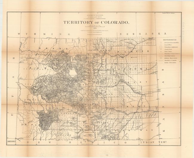
This is a scarce edition of this large survey map with terrific detail throughout. Compiled under the direction of C. Roeser, it shows the large Ute Indian Reservation in the west, Military Reservations, railroads, county seats, townships, cities and towns. The map presents well-developed topography and hydrography, and the extent of surveying in the territory. Also depicted is the Kansas Pacific Railway's 20 mile limit, which cuts a wide path through the eastern part of the territory to Denver.
The General Land Office produced this map as part of a series of maps of the States and Territories to celebrate the Centennial (this was the last GLO map with Colorado as a territory). These maps were recognized as the most accurate and detailed maps of their time, and subsequently were widely used by commercial mapmakers.
References: Phillips (Maps) p. 242.
Condition: B
Issued folding with toning along the fold lines and numerous short splits at fold intersections. Several additional fold separations along the lower fold at left have been closed on verso with archival tape.