Subject: North America, Canada
Period: 1794 (dated)
Publication: The American Geography...
Color: Black & White
These four maps were published in the 1794 London edition (Stockdale) of Morse’s The American Geography, containing 25 maps. It was the first detailed compilation of maps focusing on the individual states and territories of the United States. It predates Scott’s United States Gazetteer, Guthrie’s Geography and Mathew Carey’s American Atlas, all published in 1795.
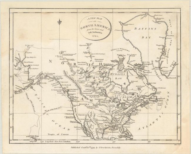
A. A New Map of North America from the Latest and Best Authorities (9.3 x 7.3"). This small map of North America was the first map in The American Geography. The United States' western border is the Mississippi River, with Spanish possessions to its west. Florida is divided between East and West. A River of the West supposedly flows into the Pacific at the Entrance of Juan de Fuca, and Cook's tracks are prominently shown in the Pacific. Engraved by Allen. Condition: A dark impression with light dampstains at top and bottom right. Remargined at top with the border drawn in facsimile. (B)
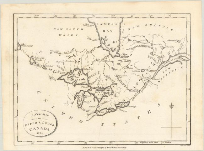
B. A New Map of Upper & Lower Canada (9.0 x 6.7"). The map is centered on the Great Lakes and extends from Lake Winnipeg in the west to the mouth of the St. Lawrence and Anticosti Island in the east. There is nice detail of watersheds, shoreline and the southern portion of James Bay. Engraved by Allen. Condition: A dark impression with a few faint stains. (A)
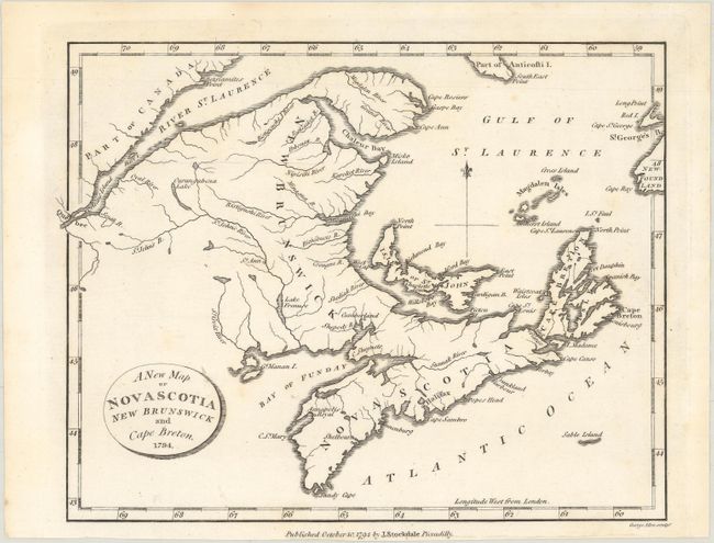
C. A New Map of Nova Scotia New Brunswick and Cape Breton (8.9 x 6.9"). Covers the region from the St. Lawrence River to Sable Island and northeast to the tip of Newfoundland. Locates Quebec, Halifax, and Cape Breton. Engraved by Allen. Condition: A dark impression with a few faint stains. (A)
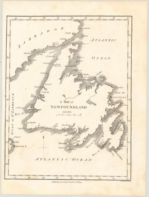
D. A Map of Newfoundland (6.7 x 8.6"). A basic map of Newfoundland and southern Labrador with place names identified along the coast. Engraved by Cooke. Condition: A dark impression with minor foxing. (B+)
References: McCorkle (18th C. Geography Books) #302 [1-4]; Howes #M840; Sabin #50924.
Condition:
See description above.