Subject: Uruguay
Period: 1833-62 (dated)
Publication:
Color: Black & White
Size:
36.1 x 24.6 inches
91.7 x 62.5 cm
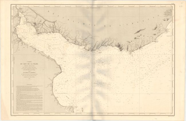
This pair of charts from Depot de la Marine covers the Uruguayan coastline in astonishing detail. The first chart focuses on the Rio de la Plata basin and spans the entire southern coast of Uruguay, extending to include the Argentinian coastline down to Cabo San Antonio. It is based on surveys conducted by Ernest Mouchez aboard the Bisson from 1857 to 1859. Mouchez was an innovator in the field of surveying and improved the way longitude is determined through his use of the theodolite and meridian telescope. Engraved by Charles Dyonnet with lettering by V. Carre.
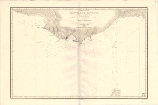
The second chart zooms in on Montevideo. It is based on surveys conducted by Captain Barral from 1830 to 1832. Engraved by Ambroise Tardieu with lettering by Hacq. Both charts feature soundings, anchorages, banks, bottom types, and more navigational information. On both sheets, Prix Deux Francs is noted below the neatline at right.
References:
Condition: B+
Both sheets have light offsetting and some minor foxing spots.