Subject: Atlases
Period: 1868 (published)
Publication:
Color: Hand Color
Size:
15.5 x 18 inches
39.4 x 45.7 cm
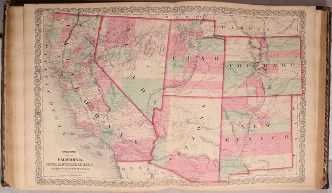
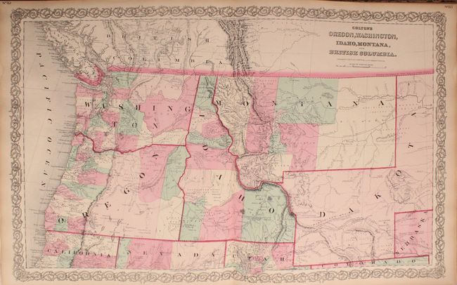
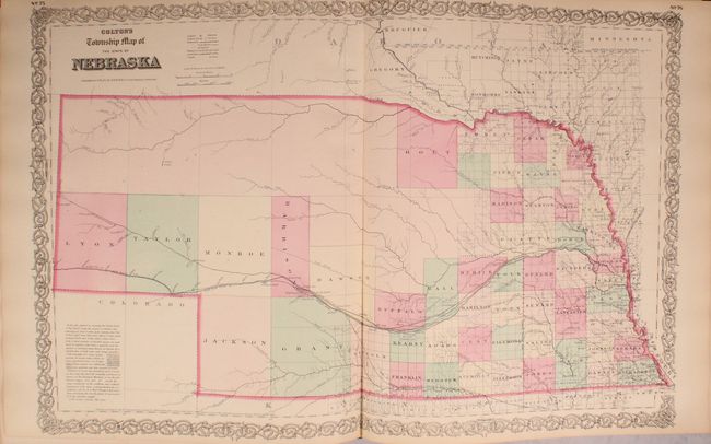
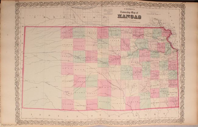
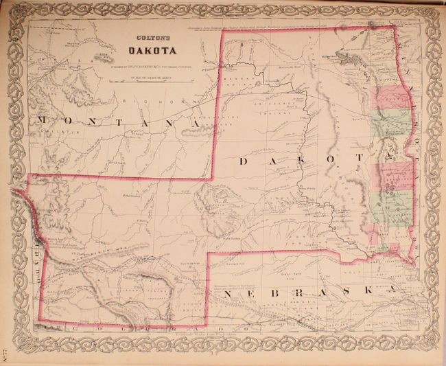
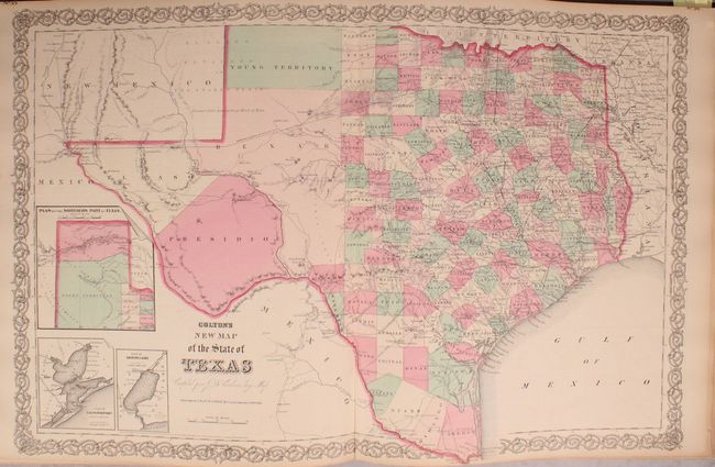
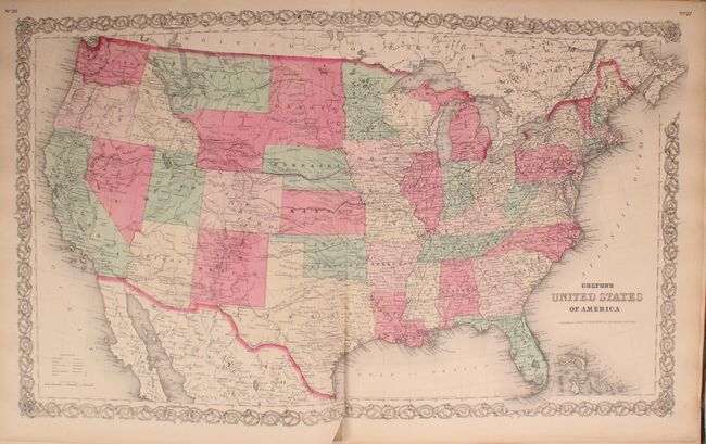
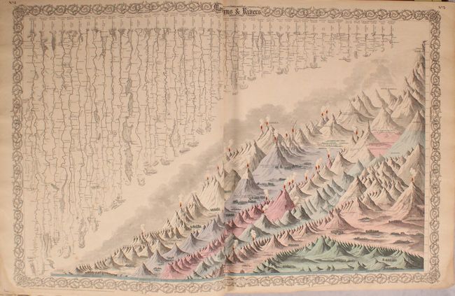
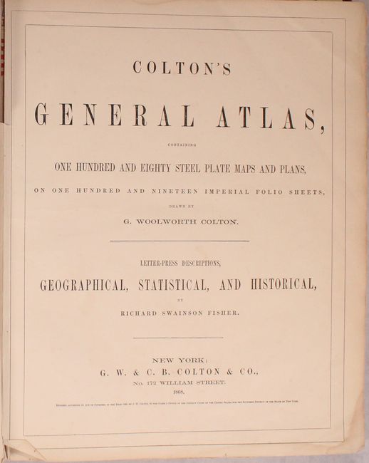
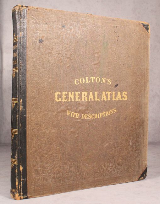
Colton's massive General Atlas, is considered by many to be the pinnacle of American cartography in the latter part of the 19th Century. There are 82 single-page and 22 double-page maps, plans and charts in all, including many highly sought-after state and regional maps such as California, Nevada, Utah, Colorado, Arizona and New Mexico and Oregon, Washington, Idaho, Montana and British Columbia. Other important state maps featured in this atlas are the double-page editions of Kansas and Nebraska, both of which show very little development in the western reaches of each state. The atlas also features several thematic maps including brightly colored examples of Mountains and Rivers and Comparative Size of Lakes and Islands. A pair of fine city plans are the single-page, uncolored versions of Environs of London and Environs of Paris. These plates were originally published in 1855, and are finely engraved, highly detailed examples that locate all major landmarks, parks, topography, train stations, rail lines and more. The plan of Paris includes a depiction of the original wall that encircled the old city. This is a beautiful example of an atlas by one of America's pre-eminent cartographers. Folio. Nearly complete, missing only the double-page engraving of the flags of all nations. Hardbound in original green cloth with quarter calf spine and tips and decorative gilt titling on front cover and spine.
References:
Condition: B+
The maps are all lightly toned with an occasional spot of foxing. Five maps have centerfold separations at bottom than enter less than 1" into image, and two of these (US and England) also have short adjacent tears. The map of India has some pencil and ink notations. There are minor damp stains along the far edges of some of the sheets. A handful of sheets, including the frontispiece and title page, are separated from the backstrap several inches at top. The back hinge is starting. The covers show moderate wear, with bumped corners, abrasions, and some small stains. The spine is lightly abraded mostly at the tail.