Subject: Mediterranean
Period: 1711 (published)
Publication: Introductio in Universam Geographiam
Color: Hand Color
Size:
13.8 x 9 inches
35.1 x 22.9 cm
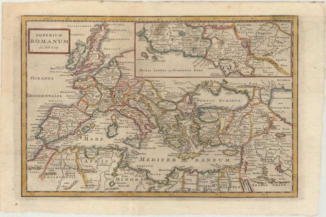
Centered on the Mediterranean Sea, this map depicts the extent of the Roman Empire. The map shows political boundaries and ancient place names, and includes an inset of a portion of the western coastline of Italy, centered on Rome. This map was published in Philipp Cluver's Introductio in Universam Geographiam, a popular atlas, appearing in over 45 editions during a 100-year period. The first edition was published without maps in the 1620s, and the first edition to include maps was published circa 1641. The various editions were published in different cities throughout Europe, including Amsterdam, Nuremberg, and London. This map is from a London edition.
References: McCorkle (18th C. Geography Books) #58-22; Shirley (BL Atlases) T.CLUV-9a #21.
Condition: A
A dark impression, issued folding with light printer's ink residue and very minor toning.