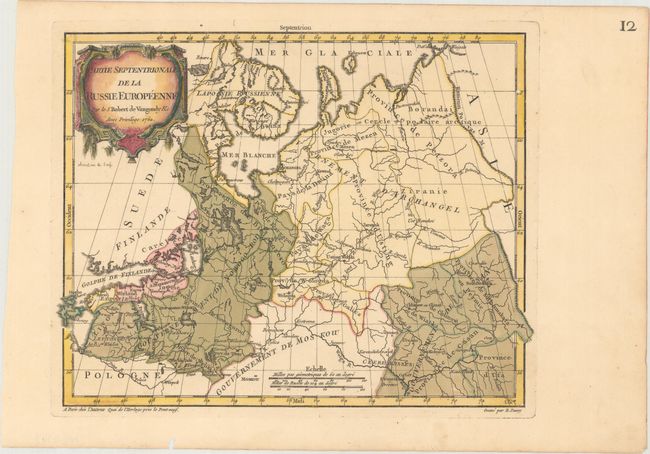
Subject: Russia & Baltic States
Period: 1762 (dated)
Publication: Nouvel Atlas Portatif
Color: Hand Color
Size:
12.1 x 9.4 inches
30.7 x 23.9 cm
This small map covers the region from the Gulf of Finland and St. Petersburg east to the Ural Mountains, here called the Kamenoi Povas M.. Riga in Poland is located and Moscow is shown in the extreme south adjacent to the distance scales. Most of Finland and northwestern Russia is included. Details include mountains, rivers, political boundaries and key place names. The large decorative title cartouche fills the upper left corner. The map was engraved by E. Dussy and the cartouche by Arrivet. This is the first state.
References: Pedley #81.
Condition: A
A crisp impression with original color in the map and later color in the cartouche. There is one small worm hole in the border at right, and another along the bottom edge of the sheet.