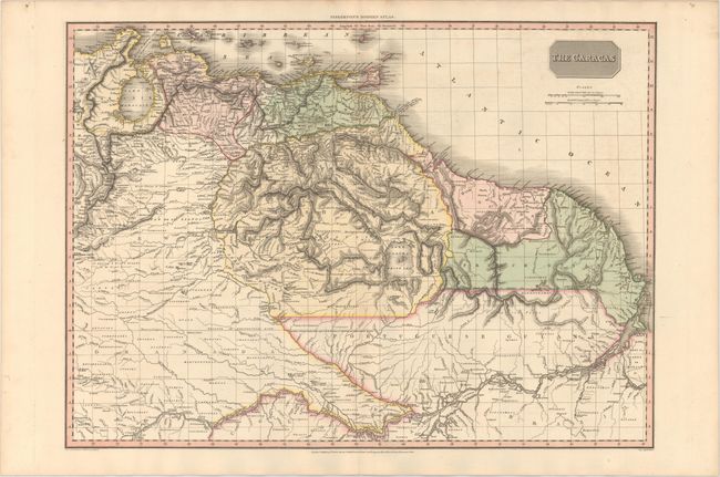
Subject: Northern South America
Period: 1810 (dated)
Publication: Modern Atlas
Color: Hand Color
Size:
27.3 x 19.7 inches
69.3 x 50 cm
This precisely engraved map covers the region from Lake Maracaibo to the Amazon River. The map was issued at the outset of the tumultuous Venezuelan War of Independence and civil war which engulfed the region. The region is divided into Venezuela, Maracaibo, Cumana, and the Spanish, Dutch, French and Portuguese colonies in Guyana. The title reflects the Caracas Junta that led the Venezuelan fight for independence. This map is one of the last to show the mythical Lake Parima, which is here also labeled as the White Sea.
References:
Condition: A
Full original color on paper watermarked "J. Whatman 1810" with a hint of offsetting.