Subject: Gulf of Mexico, Caribbean & Southern United States
Period: 1666 (published)
Publication: De Zee-Atlas, ofte Water-Weereld
Color: Hand Color
Size:
21.2 x 17.6 inches
53.8 x 44.7 cm
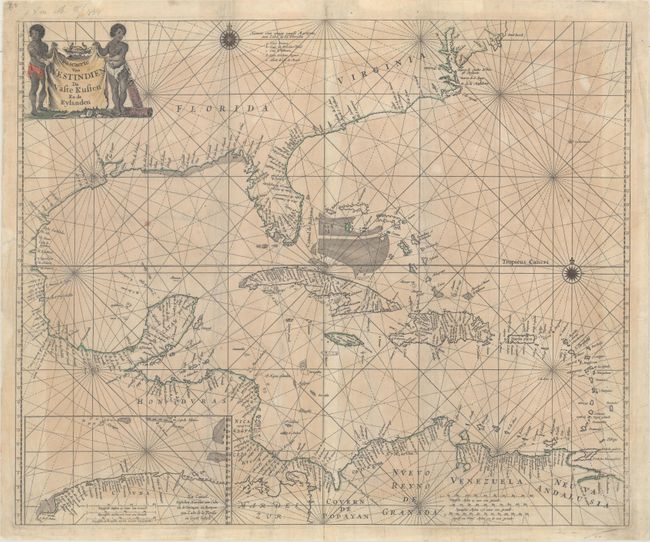
Goos' scarce map of the Gulf of Mexico and Caribbean was based on Hessel Gerritsz' map of the region published circa 1631, which influenced numerous derivatives. Goos included updates from other derivatives, including the cartography of the Gulf of Mexico as depicted by Joannes van Loon, circa 1661, and the mildly sloped coastline of the Southeast U.S. as depicted by Hendrick Doncker, circa 1659. However Goos' map was the first derivative to include Gerritsz' inset of the northern coast of Cuba, which fills the bottom left corner. Goos also made some improvements, such as the depiction of the Outer Banks. The map is adorned with two compass roses and the title appears on a cow hide held aloft by two cherubs.
References: Burden #389.
Condition: B
Backed with tissue to reinforce and repair several centerfold separations at top and a 3" tear just above the inset at lower left. There is light, uneven toning and numerous repaired small chips and edge tears confined to the blank margins.