Subject: Washington
Period: 1883 (dated)
Publication:
Color: Hand Color
Size:
26.5 x 16.3 inches
67.3 x 41.4 cm
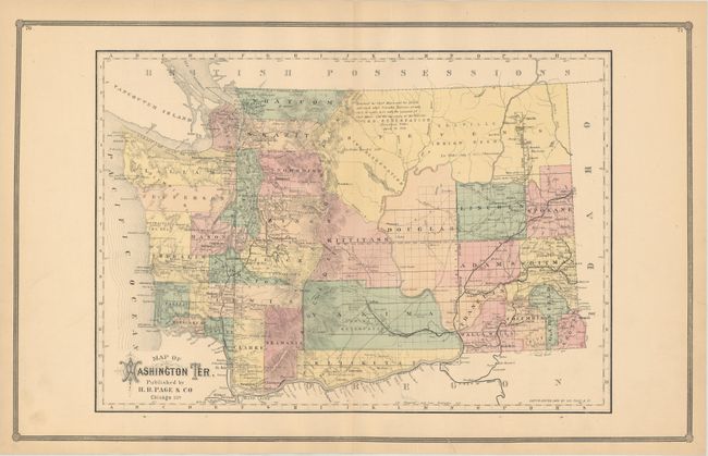
This large map is a scarce issue of Washington Territory by the little-known H.R. Page & Co. firm of Chicago. Development is primarily along the coastline as well as along the railroads in the eastern portion of the territory. The center of the territory is occupied by the large Stevens, Douglas, Kittitass and Yakima counties. A note in Stevens County indicates lands "Reserved for Chief Moses and his people." An uncommon map issued 6 years before statehood.
References: Ristow p. 443.
Condition: A
Nice impression and color with two minor archival tape repairs confined to the blank margins.