Subject: Texas
Period: 1882-92 (circa)
Publication:
Color: Hand Color
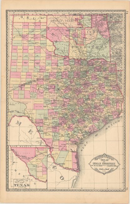
A. Tunison's Texas and Indian Territory, by H.C. Tunison, circa 1892 (12.9 x 19.6"). In Tunison's style, this is a finely lithographed map with original bright coloring. By this period most mapmakers had adopted printed color rather than the more labor intensive hand coloring employed here. It is decorated with a Victorian style border and title cartouche, which gives the population of Texas as 2,235,523 and no population reported for Indian Territory. At lower left is an inset "The Western Part of Texas on Reduced Scale." Indian Territory is clearly divided into about 25 different Indian lands. Green County, originally established in 1860, is here unnamed and still part of Texas. It was abolished and awarded to Indian Territory by a Supreme Court decision in 1896. There is good detail of railroads with all stops located and named. Tunison's maps were printed on both sides; on the verso are single-page maps of Nebraska and Alabama. Condition: On a clean sheet with a 1.5" fold separation at left that has been closed on verso with archival tape. (B+)
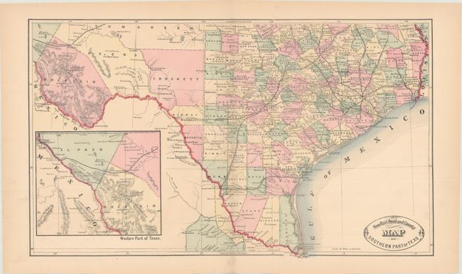
B. New Rail Road and County Map of Southern Part of Texs, by George Cram, circa 1882 (19.5 x 11.6"). This early Cram map was issued in his scarce Unrivaled Family Atlas and is unusual for its use of hand-coloring (nearly all Cram maps were issued with printed color). The map extends from the Texas/Louisiana line west to Tom Green, Pecos and Presidio counties with both existing and proposed railroad lines depicted. Includes an inset of far western Texas. Interestingly, the map misspells Texas as "Texs". Condition: On a clean sheet with one small edge tear confined to the bottom blank margin and repaired on verso with archival tape. (A)
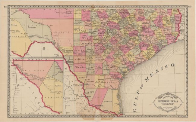
C. Tunison's Southern Texas, by H.C. Tunison, circa 1885 (20.1 x 12.6"). A nearly identical map to the above with two additional completed railroad lines in Kinney and Maverick counties that border the Rio Grande. The verso contains single-page maps of Wisconsin and Minnesota. Condition: There is a small area of toning along the lower centerfold and a few small stains along the top border. (B+)
References:
Condition:
See description above.