Subject: Oklahoma
Period: 1906 (published)
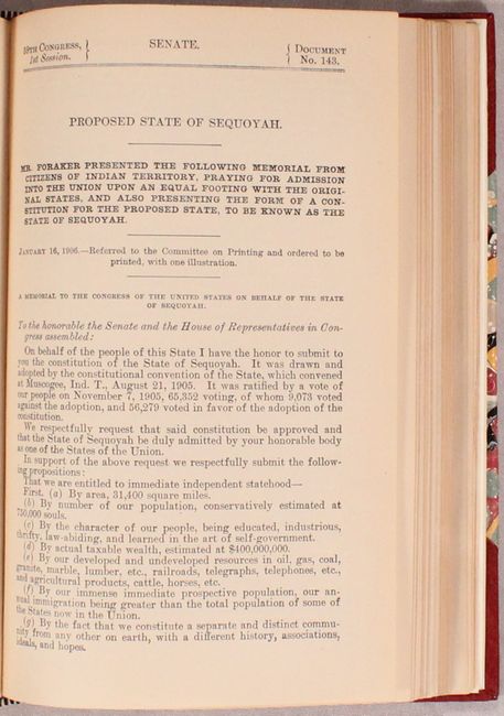
Publication: Sen. Doc. 143, 59th Congress, 1st Session
Color: Printed Color
Size:
14.8 x 16.2 inches
37.6 x 41.1 cm
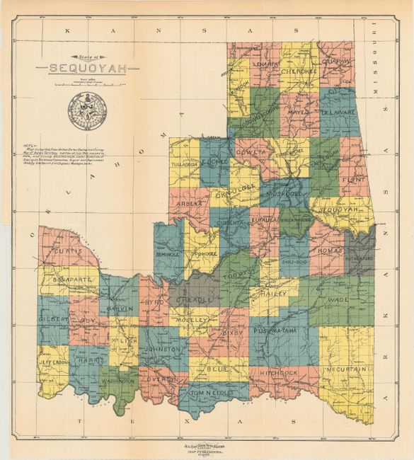
In 1905 the Five Indian Nations, concerned how statehood for Oklahoma might affect them, held a constitutional convention with the view to forming their own state. A constitution was formalized and submitted to Congress and included in the 87 page "Proposed State of Sequoyah" presented here. The report lays out a comprehensive argument for statehood, while its citizens were "praying for admission into the Union upon an equal footing with the original states." The scarce and desirable map included with this report partitions the Indian nations into 48 counties. In 1907 Oklahoma did indeed gain statehood and, as the Indians feared, absorbed Indian Territory in the process. At that time, Oklahoma retained the names of 20 of the 48 counties from the State of Sequoyah. A large depiction of the "Great Seal of the State of Sequoyah" is below the title. Drawn by D.W. Bolich and printed by the Aug. Gast Bank Note & Litho Company.
According to Howes, there are three publications related to the state of Sequoyah and its constitution. The first was the 68 page constitution published in Muskogee, OK. in 1905, the second was an unofficial 50 page version of the constitution without the map published in Guthrie, OK., and the last is the official 87 page version presented here. The Streeter reference is for the first edition.
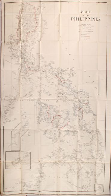
The full report also includes several other documents including (among others): Doc #140 - "Departure from published rates by Atchison, Topeka and Santa Fe Ry."; Doc #141 - "Development of American merchant marine and commerce"; and Doc #156 - "Proposals for contracts for construction of railway lines in Philippines" which includes the large folding "Map of the Philippines" (24.5 x 45"). Rebound in faux leather over marbled boards.
References: Howes #S295; Streeter Sale (Vol. 1) #605.
Condition: A
The map, issued folding, has pleasant light toning with one tiny split at a fold intersection. Text is also lightly toned but is otherwise clean and tight. New binding is pristine.