Subject: Colonial New Jersey
Period: 1777 (published)
Publication: Universal Magazine
Color: Black & White
Size:
11.4 x 14.4 inches
29 x 36.6 cm
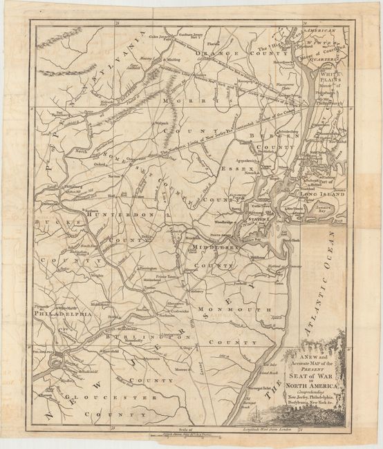
This fascinating Revolutionary War map focuses on New Jersey, a pivotal state for many major battles. The map was published in the June 1777 issue of Universal Magazine, just months after battles at Trenton and Princeton. Somerset Court House (now Millstone) is shown along the Milton River. Morristown, a strategic encampment site for the Continental Army during the winter of 1777 does not appear on the map, although the area north of White Plains, New York is labeled as "American winter quarters." Dashed lines depict the boundary between East and West New Jersey, as well as three boundary lines between New Jersey and New York based on what was "contended in favor of the crown," the jurisdiction based on the previous 50 years, and the line "as settled by the Commis.rs in 1769." The map includes Philadelphia, Manhattan, and Long Island. Early roads, towns, and county lines are also depicted. An uncommon map.
References: Jolly #UNIV-178; Sellers & Van Ee #1050 & 1241.
Condition: B+
Issued folding, and now flattened, on watermarked paper. There is light offsetting and professional repairs to a tiny binding tear at bottom and a short fold separation at top.