Subject: Illinois
Period: 1854 (published)
Publication: A New Universal Atlas...
Color: Hand Color
Size:
13.1 x 15.6 inches
33.3 x 39.6 cm
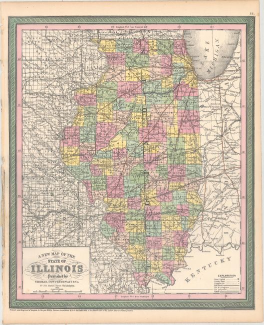
The state here appears nearly fully developed lacking only Ford and Douglas counties, both of which were created in 1854, making the county configuration correct to 1853. The effects of early internal improvements and rapid settlement are many. No less than 6 rail lines originate in Chicago, branching out to serve all but the most southern counties. Brightly colored by county, with transportation routes highlighted. Although copyrighted 1850, this map was published in 1854, just prior to Cowperthwait, Desliver, and Butler joining as publishers.
References:
Condition: A
Original color on a clean, bright sheet with minor toning along the edges of the sheet.


